Sunday, March 31, 2013

Getting Better All The Time

Got to admit, the weather is getting better for paddling comfortably. It's cool enough that there aren't swimmers everywhere, the water is still pretty clear, and wearing my wetsuit is still comfortable. I like this weather!
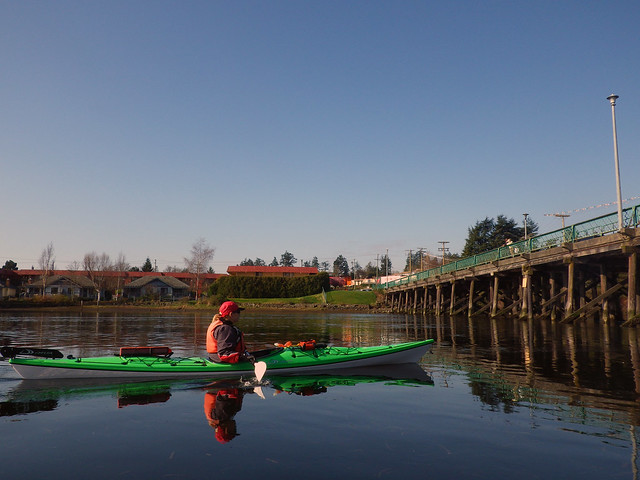
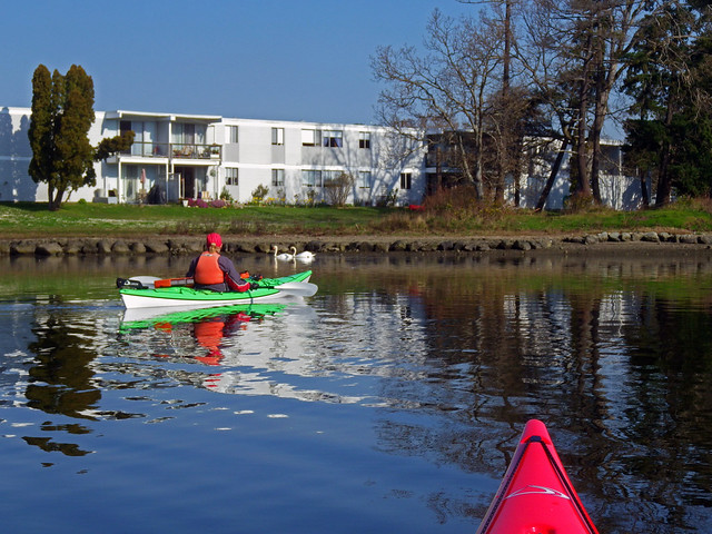
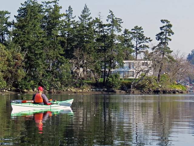
Plus, a beautiful fogbank blew in while I was paddling on Good Friday. As I came back to the shore at Cadboro Bay's Gyro Park beach, two people walking came up to me. Pam and Caroline both enthused about how they watched me approaching the shore, bringing the mists behind me.
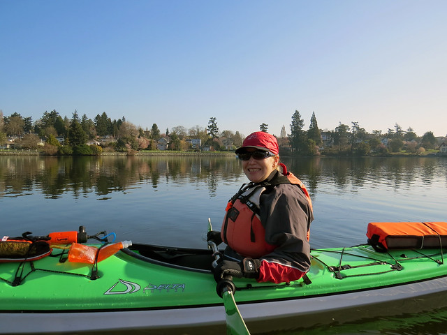
Then, of course, they had to enthuse about my little inflatable kayak... several minutes were spent here praising the merits of kayaks in general, and this model or its big brothers in particular. I never even got a chance to tell them what I'd seen on this paddle outing -- three invertebrates that I rarely see, and one that along this shore isn't usually nearly this big!
Invertebrates sounds so cool... I nearly named this post after them, but thought better of it. Four sluggy creepy beasts sounds soooooo less technical and interesting than four invertebrates. But there you have it. Plain language doesn't always have the zip and pizzazz of highfaluting precise language. So here goes for descriptions of the three sluggy and one prickly friends I saw while drifting on the water. (And for those who don't speak highfalutin', invertebrate means "animal with no backbone" which includes a whole range of kinds of animal from bugs to slugs and sea stars.)


The first invertebrate I saw was a sea cucumber, which had stuffed itself between a couple of rocks on Evans Rock, right about where I saw the gray whale two summers ago. We've seen only one sea cucumber before while out paddling, and that was about half a mile away from Evans Rock in the Chain Islets. During one low tide back in 2007, a group of us paddled to the Chains and Bernie found a large orange sea cucumber, grazing on kelp, which John photographed. The little sea cucumber I saw this time was similarly orange, but short and very bright in colour, with a flare of gills showing like a frilly flower.


photo from Wikipedia

The second invertebrate -- and the prickly one -- was a sea star. Most starfish we see here along the shore of Cadboro Bay are the kind that our fellow paddler Alison Sinclair identified as ochre stars, or Pisaster ochraeous, bright orange or purple, up to the size of a big man's hand. Once a year or two a giant sunstar, pink or pale orange and about two feet across, can be seen creeping along a rock shelf on the bottom near Flower Island. This time what I saw as I paddled around Flower Island was a purple sea star that was over a foot across. Wow! It was clinging to a rock exposed at low tide, unconcerned when I came by and petted its rough back.

yup, another photo from Wiki
The third invertebrate was a sea slug, or nudibranch, about as long as my hand, clinging to the eelgrass growing in the channel between Flower Island and the point. Oh yeah! I drifted past it, spun round and went back to get another look at it, some three or four feet down. I've seen only one or two of them before -- one was a bright red slug the size of my thumbnail, in a tidal pool at Botanical Beach on the west coast. We've seen the eggs of nudibranchs while paddling in Portage Inlet, but the actual sluggy creatures have been harder to see. This one was a little different from the local land slugs and the red one I saw thirty years ago: it was not smooth-backed, but looked almost like an African pygmy hedgehog, if a hedgehog could be squoodgy like a slug. Apparently it was a type of nudibranch called an Aeolidia papillosa, based on what I read at Wikipedia.

The fourth invertebrate was actually one of several sea anemones ... I lost count at five or six. They were ten or more feet down. These were the big white anemones with fronds like heads of cauliflower, and each anemone was about a foot long, from its base to its open fronds. When I do see an anemone like this in the bay, it's six or eight feet down even at low tide, and usually alone. It was great to see the group of anemones about two feet apart, with their fronds open and waving.

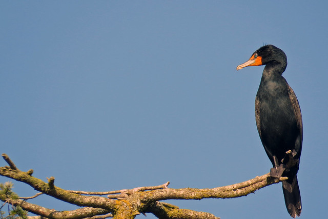
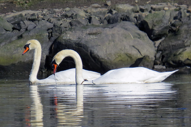
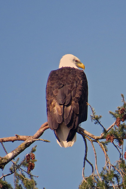
So, even though it was a pleasant cool day, with coots and hooded mergansers and a merganser, a cormorant, a pair of oystercatchers and a pair of soaring eagles, the best part for me was that there was plenty to see going by under my kayak as well as flying past. It was a surprise to hear the foghorn grunting, and see the fogbank coming my way from the Chathams. It's so good to think about more living things in the bay than we've ever seen before. It looks like the waters of the bay are more suitable for more invertebrates now than even five years ago! Perhaps the water is cleaner, or perhaps the river otters are eating enough sea urchins that more kelp is growing to support the web of sea life.

Friday, March 29, 2013

Sunny Day

The weather this March has not been great. Rainy, windy, generally blah days. But today it's 13 degrees and sunny, a gorgeous spring day, and a good Friday by any definition.
The sluggish start to our paddling year continues as Louise is struggling with some small joint aches and pains. But smiles come easy on a gorgeous day like this even if you aren't feeling one hundred percent.
IMG_1408

Today we rolled our kayaks down the hill and hit the Gorge for a little paddle. Almost immediately, the local swans swam by to check us out.
IMG_1434 copy

We noticed last year that the top of what we call "Cormorant Tree" had broken off. We called it that because local cormorants would sit in the tree and spread their wings to dry them. This year, we see that they've moved to another tree to dry off in.
IMG_1416 copy

We moved up The Gorge and paddled under the Craigflower Bridge into Portage Inlet. Take a good look, this might be one of the last pictures you'll see of the bridge as construction of the replacement begins soon. The electrical wires have already been moved and traffic detours begin next week.
IMGP0097

We paddled by the local swans....
IMGP0100
...who nest here every year. Maybe we'll see some baby swans in a couple of months.
IMG_1442 copy

Of course, we aren't the only ones hoping to see some fluffy swan babies in the future.
IMG_1453 copy
But today the eagle seemed content to just enjoy the sun as we paddled by.

With the tide ebbing, we didn't get too far into the other half of the inlet as the inlet shallowed out and we scraped the sandy bottom. So we turned around and let the current take us back.
IMG_1447


Trip length: 6.82 km
YTD: 18.22 km
More pictures are here.
2013-03-29

Thursday, March 21, 2013

This is The Sea 5


At the risk of repeating myself and others, there's no one making better kayaking films than Justine Curgenven. And certainly there can't be many kayakers who travel to so many varied places, or have as much fun while doing it. Perhaps that's her secret as a film-maker; she's so effective at showing the joys of her kayaking adventures in her films, but also doesn't shy away from the emotional toll when things go wrong either.
Her latest collection, This is The Sea 5, has just been released and should be on every paddler's "must see" list. The eight films are divided evenly between shorter kayaker profiles, and longer expedition pieces. Of the shorter pieces, I really enjoyed the feature on Harry Whelan surfing ferry wakes along the Thames -- what a cool idea! But for me, the highlight is always the expedition films, and there are some great ones featured here, from the beginning legs of Sarah Outen's attempt to circle the world on human power, to Justine and Barry Shaw circumnavigating Sardinia. The highlights are Justine's and Barry's attempt to paddle around the remote island of Tierra del Fuego, a wonderfully told story that is at times as disheartening as it is triumphant. But perhaps the gem of the DVD is a kayaking tour around some volcanic islands in Sicily which is one of the best touring films I've seen in awhile, a great blend of kayaking and sight-seeing, with an ample helping of Sicilian culture.
Run, don't walk, to the website and order this dvd. Watch it, and rediscover why you fell in love with kayaking in the first place.

Wednesday, March 20, 2013

South Solo

Three years ago, Hayley Shephard set out on an expedition to paddle solo around South Georgia Island, a remote island in the south Atlantic. Looked at strictly as an expedition, one could make the case that it was an abject failure. A serious injury to a crew member of her support vessel almost scuttled the paddle before it began, and the delay while a replacement was found left Hayley with a reduced weather window. Her primary kayak was smashed up during delivery. Held up by high winds, she was unable to complete her circumnavigation before she had to fly home, and she completed only about one-third of of her expected distance.
But, as the old Rush lyric goes, “the point of the journey is not to arrive,” and the point of Hayley’s journey was to publicize the plight of the albatross. In her book South Solo: Kayaking to Save the Albatross, Hayley describes how endangered species of albatross are struggling to survive as increased fishing takes its toll on them as they fatally strike hooked bait fish on longlines, and as we continue to poison our oceans...and theirs.
In her book, Hayley takes us through her expedition planning, her travel to the south Atlantic, and the tribulations that almost scuttled the whole expedition before it began. But it’s her encounters with the South Georgia wildlife during her truncated sojourn that stand out for me, as she wonderfully describes encounters with penguins, seals, and, of course, albatross. (And the book has some terrific colour pictures, something I wish more kayaking books would have. But I digress.)

Brooks Point Regional Park

Just received another press release from Laurie Sthamann  at the Capitol Regional District Parks branch. It's good news -- through a lot of hard work and generosity by several people and groups, CRD Parks has been able to afford the costs associated with adding land to Brooks Point Regional Park on Pender Island! Kayakers rejoice at oceanfront park land!


Media Release
For Immediate Release
March 18, 2013

CRD Partners with Pender Community on Lands for Brooks Point Regional Park

Victoria, BC - The Capital Regional District is entering into a contribution agreement with the Pender Islands Conservancy Association (PICA) to retain and protect a parcel of land at Brooks Point Regional Park.
In 2010, the CRD purchased 1.17 hectares of land to complete Brooks Point Regional Park on South Pender Island. The CRD borrowed $1,650,000 to purchase the land, and has been working with the Pender community to explore options to recover all or a portion of the net purchase cost of the property.
“The CRD is now able to retain the entire parcel thanks to the fundraising efforts of PICA, and others such as The Land Conservancy of BC, Poets Cove Resort and
Purdy’s Chocolates,” said CRD Regional Parks Committee Chair Susan Brice. “This parcel of land has been high on the CRD Regional Parks’ priority list to join two park segments separated by private property.”

"PICA's commitment to raise $150,000 with support from conservation partners, in addition to the $152,000 raised to date with strong community support, ensures that Brooks Point Regional Park will be saved in its entirety for future generations," said Monica Petrie, co-chair PICA Brooks Point Completion Committee.
"I am particularly proud of the effort that PICA and the Pender community have put into this effort to conserve Brooks Point,” said Director Dave Howe, Electoral Area Director for the Southern Gulf Islands. “This project exemplifies a strong community relationship between the non-profits and for profits on the island.”

The Land Conservancy of British Columbia (TLC) is contributing funds over four years to the CRD to pay for the $124,550 in interest costs that the CRD incurs in borrowing funds to acquire land. Through their Chocolate Lily Package, Poets Cove Resort along with Purdy’s Chocolate raised $20,000 towards the acquisition.
The CRD, TLC, Pender community, Nature Conservancy of Canada, Habitat Acquisition Trust and Islands Trust Funds participated in a fundraising campaign to purchase the original 4.8 hectares, including Gowlland Point, in 1998 and 2000. The Brooks family also donated a parcel of land valued at $225,000.

Brooks Point Regional Park is an oceanfront park featuring an intertidal rocky shore and beach, meadows with exceptional displays of Chocolate Lilies and commanding views of Boundary Pass and the San Juan Islands. It contains nationally endangered Sharp- tailed Snakes and rare ecosystems including a small Garry Oak stand, coastal grasslands and coastal bluffs.

For further information, please contact:
Laurie Sthamann, Communications Coordinator
CRD Regional Parks
Tel: 250.360.3332 | cell: 250.889.8030
lsthamann@crd.bc.ca
www.crd.bc.ca/parks

Monday, March 18, 2013

Navigate With Something More Than Google Maps!

Now that anyone with a computer is "living at the Library" it's easy as pie to get maps and charts for pretty much anywhere. Well, maybe not easy as pie, but do-able.
Here's a reminder that when you're planning a kayaking or canoeing trip, try to get more information than you can find at Google Maps. Look up a canoeing guide, or a kayaking blog. What do the yacht enthusiasts and fishermen have to say about the area where you want to go? Find some maps and charts designed to be used by small boaters. I'm not dissing Google Maps or Mapquest... it can be very handy to look at road maps and satellite photos online. I'm just saying that the best preparation comes from combining online maps & photos with paper maps and local knowledge.
Printed maps have details on them that are meant to communicate more than just where the roads go or which way the rivers run. If you've never taken a map-reading class, pony up for one at a recreation centre or a paddling festival. Yes, I mean that if you have to pay for the class, pony up, cuz it's worth it. There's heaps of knowledge on every chart and map at the public library. The bicycling map for Greater Victoria has details of interest for paddlers too, such as which roads have steep hills... that's something to think about when one is pulling a kayak along on wheels.
Before I paddled down the Red Deer River last year, I'd read several trip reports from paddling clubs in Alberta and across Canada, like Paddle Alberta. I didn't just stick to reports on that particular stretch of that particular river, either... which is how I noticed the many occasions on which rivers rise suddenly following or during rainstorms. Every night I slept on the riverbank I lugged my gear above the summer high water mark, and made note of where the winter high water mark lay along that particular shore. At one site, a cabin owner had marked the high water point with a hand-lettered sign. I took care to lift my kayak to an inconvenient but necessary height above the river each evening, and tie this light inflatable to a tree even when this meant connecting my throw bag, bow painter and a bungee to stretch the distance; that night, the kayak looked like a dog pulling on a very long leash. Results paid off immediately, as each night the rain poured down in thundershowers, but I never had to venture out in a downpour to move my kayak or tent. I'm a flatwater paddler most of the time, on seashores and lakes -- it was reading forum notes from river kayakers and canoeists that reminded me to do these simple preparations in an effort to be prepared for flash floods.
As well, I didn't rely only on anecdotal reports from one-time noodlers. I bought a map through Mountain Equipment Co-op, and had it laminated at the local copy shop. This map was made by Mark Lund, and it was worth any price. Go to Paddle Alberta's page here, and scroll down to see if Mark has made a map for a river you plan to paddle; with 60 trip reports, he just might. Heck, if you're looking for a good armchair read for vicarious paddling, pick up a copy of his book Mark's Guide For Alberta Paddlers, which has all those trips in it. It'll fill you in on details for trip planning, for camping in general, and for understanding why it's so important to know what those wiggly lines mean on a map or chart.
By the time I actually set up my inflatable on the riverbank and said goodbye to my ground crew (thanks Lila and Sapphira!) I had been jonesing for this trip for over three years. I was also confident that Mark Lund knew what he was saying when he called this portion of the river a safe trip for a paddler with almost no whitewater experience, as there was no whitewater. There was one riffle, not even a Class 1 rapid, which scared the snot out of me but was exactly where it was marked on the map, and was exactly the conditions the trip reports said it would be.
In spite of all the preparations, I was one small paddler in a small boat, alone on a stretch of the river that I had seen only on satellite photos. That laminated map was bungeed firmly to my boat. You can't always rely on online maps and satellite photos, as I knew well from calling up my home location on Vancouver Island, and noting how some of the islands offshore are simply not there on the online maps. Whole islands disappear -- islands I've seen or been to -- for one reason or another.
As well, there are islands on maps which simply aren't there in real life. The SPOT website people posted a little note about this phenomenon the other day, noting that Sandy Island, in the South Pacific, has been taken off the maps as it apparently never existed. Check out this link to learn more.
Islands that don't exist get onto maps for any of several reasons. Mirages, bad chart-making, mistaken log entries by bad navigators -- these are only a few causes for imaginary islands to appear on maps. But maps without existing islands? Other things are going on.
Any one map, particularly a commercial map for businesses or a reference map, has at least one artifact that is not accurate; these artifacts are made so that the person who owns the copyright for the map can prove in court that someone else is selling copies of a proprietary design. "Look, here's Blahblah Crescent drawn as a cul-de-sac with a turnaround. There is no BlahBlah Crescent at that spot, it's an undeveloped road allowance between two vacant lots in an industrial park!" These little fake details are carefully put in places so they won't be dangerous for people reading the map.
That's part of why you'll see on many road maps the notation: Do Not Use For Navigation At Sea. A car driver needs to see two islands in a bay only as rocky lumps barely visible from a road winding around a bay past buildings and tall trees. A kayaker needs to know that there are two islands and a reef barely underwater at low tide, where the current which is minimal elsewhere in the bay can suddenly rise to make standing waves over the reef.
On the other hand, when Bernie rented a kayak in downtown Toronto and paddled across the harbour to the Toronto Islands, the rental store gave him a paper placemat to use for a map. It was sufficient for their purposes, when combined with local knowledge and particularly the advice to stay inside the islands and out of the way of sailboats. No better map was needed in that place. Bottom line: there's information available in lots of media to help us have a good time on the water.

Sunday, March 17, 2013

Joseph McLean in Howe Sound

One of the real treasures about living here on the West Coast is going out in small boats with a variety of friends. One day, Bernie and I took a very small ferry from Gibsons Landing to a nearby island, hiked around with Joseph and Katie, and stood on the shore to watch slack-jawed as All The Coots In The World surfaced in the bay in one massive flotilla. 
Today, our friend Joseph posted his photo from March 13 2011 and a thoughtful comment to caption it:

Coastal cross-section, along the edge of Howe Sound. How many of these bays and coves fill our shores, with their rocks and bluffs and weathered trees? How many have I floated past, by ferry, canoe, kayak, or sail? And how precious few have I actually landed at, scrambled quickly ashore in that strange transition from water to land, to experience and explore on my own? Just a fraction of a percent in all this wild coast, this great mystery of a landscape. May it always be like this, charted and borrowed but never fully solved, raw and pure and free.

You can read more about and by Joseph and see some of his photographs at his website.

Saturday, March 16, 2013

Ocean River Gear Up Sale

If it's March in Victoria, it must be time for another Ocean River Gear Up sale. Twice yearly, Ocean River takes over the parking lot across the street from the store for a big sale. Usually, the weather cooperates, but not today, a miserable and blustery day.
I'm not sure how much Louise's umbrella helped.
IMGP0665

We bumped into Mark and Robyn, and Mark clearly had the look of someone who was adding another boat to his fleet.
IMGP0667 copy

We all checked out the new Delta 15s and chatted with the Delta rep.
IMGP0670
The 15s has a bunch of new features, including a new seat and hatch covers, and we were pleased to learn that these updated designs were going to be carried over into the other boats in their fleet as their kayak line gets refreshed over the next couple of years.

The showers continued to pour down and the wind came up, and most people took cover under the merchandise tents, leaving the kayaks alone in the rain.
IMGP0671 copy
We were ready to pack it in when a familiar voice called out, our buddy Mark Hall, now with Kayak Distribution, who deal in Boréal Design, Tahe Marine, Zegul and Riot kayaks.
IMGP0672 copy
He invited us to take shelter in his trailer, where we spent a while catching up and avoiding the storm outside.
We managed to escape without the sale without spending a cent, although we did walk away with Boréal Design hats and t-shirts. Thanks, Mark!

Friday, March 15, 2013

Registration Open For 2013 Pacific Paddling Symposium

Registration has opened for the first (and hopefully) annual Pacific Paddling Symposium. Set for May 31 - June 2, it promises to be a terrific weekend on the west coast just outside Victoria with nearly two dozen coaches, including Dubside and Ginni Callahan, as well as local coaches such Alex Mathews, Gary Doran, Micheal Pardy, and Mike Jackson. Check out the schedule, and register here.

March 27 addendum: Annnnd it's sold out!

Thursday, March 14, 2013

Baby Seal Hitches a Ride in a Kayak


When a diver in California surfaced and began loading his gear back into his kayak, he soon found that he had an unlikely but persistent passenger: a baby seal. Check out the video embedded below:

Still More To Catch Up On, and Floating Garbage

Another "no paddling" day even though the weather is spring-ish (well, it sure aint winter here) and no wind. By noon, we had done three errands -- gone to the nursing home to see my Dad, borrowed Mom's car to bring over a sturdy little table for Dad, and then Bernie went back to bring Dad's magnifying reader to put on the table -- and then, after Bernie carried the hernia-making reader (like a microfiche reader) he trotted off for the bus to visit Marlene in hospital. Sad to report that one of our paddlers, Marlene, is now in hospital again, this time with a newly-repaired broken thigh. Her role in paddle outings this summer is likely to be limited to ground crew and SPOT message receiver. It'll be kind of hard to fit a thigh cast into any kayak cockpit, but maybe she'll be towed along in the red Pamlico or ride up front on the sit-on-top inflatable StraitEdge2 double...
A rare example of floating couch photographed by John -- not Marlene's summer kayaking gear!

Still thinking positive kayaking thoughts about making the world a better place for small boats. With that in mind, I ask: Did you see any trash in the water the last time you took out the kayaks for a quick circuit of the lake? We did, and collected a few beer cans that were drifting. How about trash in the ocean? That trash isn't as easy to tag as the fault of "yesterday's lazy drunk person" because some trash floats a long, loooooong way from whereever it was discarded. Some trash is just bewildering, other stuff has names and addresses on it. Would sure love to make whoever dropped this couch in the Gorge haul it to the dump!
Some trash from the Japanese Tsunami is making its way to our shores here on Vancouver Island, but we've got to keep that trash in perspective, as local cartoonist Raeside shows in his recent drawing.

Thanks to Raeside for his always-insightful editorial cartoons!

Keep in mind that it's a good idea for us small boaters to pick up some of the most troublesome floating garbage, carefully, and to participate in local clean-up events for local waterways. Some kayak rental places will give paddlers a free garbage bag to take along, and if the paddlers return with a full trash bag the rental bill is half price. Small efforts pay off a little at a time, and so does keeping in touch with the local governments' programs for landfills and other waste disposal.

Wednesday, March 13, 2013

Loving that SPOT

Just another reminder how much I love having a SPOT clipped to my life jacket. Every time I go out in my kayak, I can call for help if needed, or call friends for a ride cuz I had some problems, or do what I do so far: tell my friends that I'm OK out on the water or hiking right here! Sure, most of the places I go are the same few places, but it's still nice to have. It was even better to have when I paddled down the Red Deer River -- go to this link and scroll down to see the maps I made with the SPOT OK messages. And my dad doesn't worry about me being on the water the way he worried before I got the SPOT. Dad's got enough to do since his stroke; he doesn't need to worry about me.

This image shows the new model of SPOT device, with the cover for the SOS button moved aside.
Today I read another news article about people being saved because of using SPOT alerts. This time, the article was from NunatsiaqOnline, quoting a message delivered March 11 in the Nunavut legislature by Lorne Kusugak, minister of Community and Government Affairs. During 2012, 53 people were found by Search and Rescue in Nunavut because they had called for help with a SPOT. Check it out here.

Tuesday, March 12, 2013

Googling Kayak Trip

Sorry not to be posting on the blog as frequently this month. My excuses are that between getting my master's essay to my supervisor and visiting Dad at the nursing home, any spare time gets spent on the water rather than at the blog. But I'm jonesing for writing about kayaking, and for seeing more of John's latest photos.
Got a fun note from our friend Ken Ames, who is more of a car collector than a kayak collector, but still came up with this kayaking reference. (Hey, anyone who owns more cars than I have kayaks is one humdinger of a collector... just sayin'.)
Ken was trying to figure out how far apart San Francisco and Hawai'i really are, when he put the question out on a couple of common websites. The result? Ken reports that:
"Streets-andTrips will give the as-the-crow-flies/great-circle-distance between one point and another.
"maps.google tries to go by road instead so in trying to figure the distance from San Francisco to Honolulu it sent me by road to Seattle and then gave instruction 22 in the attached photo."


A fascinating instruction from Google Maps. At least it does include the note that the kayaking leg of the trip would be 2,756 miles. Well spotted, Ken!
 

Thursday, March 07, 2013

Motorised Submersible Canoes

odd_boats_5
Ever wanted to fly your kayak underwater? British Special Ops in World War II did just that using Motorised Submersible Canoes, or MSCs. Nicknamed the Sleeping Beauty, it could dive about 15 metres, had a cruising speed of about 3 knots, and a range around 65 km. Although difficult to control, during the war it was used by British, Australian and New Zealand forces, and one was was tested by the US.
300px-Sleeping_beauty_canoe