After the day I spent touring the Greater Victoria region with a geologist, I staggered around for many days seeing my familiar surroundings with new eyes. The first thing I wrote about this experience was the Into The Deep Past post on the Kayak Yak blog.
I should also write about the next day as well, when I went wandering into the past, but not so ancient. It was still pretty long ago by modern standards. Let me digress a little. We modern Canadians tend to think of things a thousand years old as pretty darned old. But around this part of the Island and the Salish Sea, there are traces of humans five thousand and possibly ten thousand years old. Or more. I don't know how to see the past as clearly as I'd sometimes like to do.
People in Europe can go look at the Parthenon in Greece, and see marble carvings etching in modern air pollution, or walk along Roman roads that were built to last. Two thousand years seems like a long time in Europe, with artifacts to look at all along the way. The Great Pyramids in Egypt are older, and we've still got the invoices for beer and onions for the workers, kicking around in museums somewhere. But the history books don't always tell the whole story -- like the olive tree on the hill next to the Parthenon that tradition holds was a gift from Athena herself. Or the marching songs that let Roman soldiers keep time with a 30-inch stride that added up to exactly a mile marched at the end of the right number of verses and choruses.
At least local history books about Victoria tell that the main wandering roads through Victoria follow old footpaths from before the Hudson's Bay Company built a fort here. Fort Road leads out from downtown, where the company built a fort on the Inner Harbour. Much older is Cedar Hill Road, which leads from Cordova Bay Beach south along a ridge that's now called Cedar Hill. Originally the Hill of Cedars was the bedrock hill re-named Mount Douglas for the company's chief factor and later the governor of the British colony. Mount Douglas is a good landmark around here. It's visible from most of the city, and the peninsula. When we're out on the water, the shape of Mount Doug tells us where we are along the shoreline.
When I follow Cedar Hill Road, it's easy to tell that it's been a road for a long time, long before the colony settlers started using it a hundred and fifty years ago. I don't need the historical records to tell me this. My feet tell me this as I walk along, or ride my bike. The road follows the creek up from the Cordova Bay shoreline, and then heads south, always staying out of the low valleys where streams would make the going muddy, and usually paralleling the high ground on a more level track than the highest points of the ridge. Instead of a surveyor laying out a road with a level and scopes, this route was laid by the time and motion analysis of many feet taking a sensible path. Practical knowledge can be science, too.
The old road crosses another old road, called (sensibly enough) Cedar Hill Cross Road. This pair of names drives visitors batty as they try to figure out where they're going, along roads that veer to take a slope at a more convenient angle. These roads aren't laid out on a grid like downtown. These roads are going someplace important to the people who made the original footpaths.
I could tell that these places are important, not only because local history books tell me so, but because of what can be seen along the way. There are old fields and Garry oak meadows that still bloom with camas flowers, a crop grown by the First Nations peoples. There's Spring Ridge, where good water welled up year-round. And at the end points, there were villages. At one end of the cross road was where we've built Craigflower Bridge, at the other the cross road split. One path led along the modern Beach Drive to villages where the Royal Victoria Yacht Club is now on Cadboro Bay, and Willows Beach on Oak Bay, the other led to what's now Gyro Park Beach on Cadboro Bay.
Okay, so that was a longer digression than expected for a blog post about kayaking. But really, that set of paths took me right back to my home waters in Cadboro Bay. I've taken my kayak out on the bay hundreds of times, at all levels of tide. And this day I started writing about, the day after my tour with the geologist, I set out to do an ordinary paddle out to Flower Island and back.
But I was still seeing the past all around me, manifest in the present tense. When you're out in a kayak or other small boat, you get used to being aware of the weather around you. But now I was sensitized to seeing the past. I saw the slight rise at the shoreline above the beach by the east end of the park, where the land rises for less than two metres. It's a midden, where there was a village. I saw the flat sand exposed by low tide, where clams blow little holes up, fewer now than when I was a child, but there must have been more, enough to harvest, a hundred years ago, two hundred years ago, a thousand years ago... And when I pushed off, my little boat was floating into the places where it showed me what this shoreline was like a long time ago in human terms.
It's hard to keep track of all the local names for islands and points and bays around here. There's a different name for most places in each of the local First Nations languages. Some of these places were used by different groups at different times, or at different times of year. My paddling group is learning names from charts. We also make our own names for the little rock garden, the big rock garden along the Uplands shore, the channel that someone has blocked by chaining a steel float, and where we see animals.
I'm not sure how long ago the sea level was at the point that we see nowadays as our zero tide. Only on the lowest tides at the winter and summer solstices each year does the tide get that low nowadays. But during the latest Ice Age the water level was lower still. I paddled along the shoreline where the little rock garden would have been a lumpy point of land sticking out from the rocky shore, as it is during low tide.
I looked across to the other shore that rises above the west end of the beach, and saw that there had been a slide or a slump of part of the bluff. Until then, I had been assuming that most of that bluff was made of the same rock as this side of the bay. But no, the slide showed sand. It made sense after a moment's thought. There are sandy bluffs miles up the peninsula, up near Island View Beach, and on James Island and Sidney Island. But I didn't know this bluff was made of sand. I'd never tried to climb it, so I hadn't learned what was hidden under the greenery covering the steep slope. There's plenty of greenery trailing over the rocks on the rocky side, too. It was the sand showing against the greenery that let me see from across the bay that there had been a landslide. The new edge of the bluff looked rather too close for comfort to the patio of one of the fine houses along the top of the bluff. Suddenly, I felt even less craving for a waterfront house than ever before.
And now I understood why Cadboro Bay is so shallow under that bluff when it's deeper along the east shore -- under the bluff here is like the shallows south of the bluff at the end of James Island. The sand slumps. It's been slumping since the glaciers retreated at the end of the latest ice age. When I paddle over that shallow, sandy-mud bottom, I'm paddling over ten thousand years of sand slumping into a basin scoured between the bedrock of the east shore and the bedrock of the Uplands shore along the west and south. The tides pull the sand out and spread it along the beach between the arms of the bay. There's been a sandy beach here for ten thousand years.
That's only a heartbeat in the geological time that Dr Yorath the geologist showed me how to see. But it's all the time that the Salish-speaking people have lived at this end of Vancouver Island.
I paddled a little further along, to one of the many little islands in the bay that are part of the Ecological Reserve. Don't go ashore on those islands -- they're bird sanctuaries! There are other reasons not to go ashore there, as well. These were important places for First Nations people, places of transition. There are stories shared in books and on websites about how there were stones at special places, stones regarded as ancestral guardians showing good ways to travel or where to look for food. There are similar stories from Europe about the standing stones in fields and hills. I looked at one of the little islets in the bay, with a stone on it. The first time I saw it, I knew that this stone was clearly a glacial erratic left behind by the ice. But this time, when I turned away from the little island, I looked across the bay and could see the two old village sites. The modern houses faded to my new way of seeing -- I could see that this was a good spot to look over on both villages, from what would have been a little point or peninsula, not an island.
This stone makes a good memory stone.
I drifted on for a while, paddling slowly. Flower Island was living up to its name, all a-bloom with blue camas flowers. This island was someone's place to gather camas bulbs for special feasts, right up till a hundred years ago or so. This basalt rock would have been connected to the point ten thousand years ago. The narrow channel that separates Flower is also a shallow one. I took my boat around Flower to Evans Rock, where there's another channel, shallow at low tide. Drifting along, I could see the bottom is white there, not the white of barnacles so much as the white of a shell beach. How long ago was this channel a beach for harvesting oysters and clams? A thousand years, five thousand years ago? Only at a zero tide is the water shallow enough for me to see the bottom and guess at the work of hands opening shells, gathering seafood for all those years, all those years ago.
I remember that one time I was talking with my mother about Discovery Island and the Chathams, near Victoria off Oak Bay and Ten Mile Point. She hadn't known that much of those islands are an Indian Reserve. She wondered why the local First Nations people hadn't developed that area. After all, Victoria had plenty of houses and businesses, why not there too? I tried to suggest that maybe the people who had been using those little islands for thousands of years had developed them just exactly the way that they found them most useful.

Showing posts sorted by relevance for query Into the deep past. Sort by date Show all posts
Showing posts sorted by relevance for query Into the deep past. Sort by date Show all posts
Wednesday, June 22, 2011
Sunday, June 05, 2011
Into The Deep Past
This year, I missed the first day of Paddlefest in Ladysmith, BC on a Saturday, May 14. After five years, it was a disappointment not to be there to see all the boats lined up along the shore, and talk with other kayakers. But I missed the first day of the kayaking festival for something really good instead -- something my paddling group has been looking for since we first paddled off Sidney, BC.
It was all for rocks.
One look shows how different the rocks are from one headland and island to another around Vancouver Island. There's something important to learn about geology here on the Saanich Peninsula. Look at some of our kayaking group's photos from Robert's Bay and Coal Island and the Little Group! But how to learn the local rocks? Hands-on is the best way to learn in the physical sciences. We needed a tour with a geologist. And I got one on that Saturday in May.
The Capital Regional District of greater Victoria set up the tour, finding a geologist from the Pacific Geoscience Centre on Patricia Bay near the airport. Dr Chris Yorath took two dozen of us volunteer naturalists off on a wild tour of several sites, from Island View Beach and Parker Park to Cattle Point, Finlayson Point, Goldstream River, Esquimalt Lagoon and then to Tower Point at Witty's Lagoon.
Most of these places I've been to lots of times as a child and an adult. Tower Point is a park that previously I've only seen from my kayak, when we're rounding Albert Head and going to Witty's Lagoon. You can see our blog posts on the website Kayak Yak about that area here. Parker Park is a beach access that I hadn't used before, but around Victoria there are beach accesses everywhere. The municipality of Saanich had to explain to a developer that property fronting onto Portage Inlet couldn't just cut off public access to the beach. I love it that the government is on our side on the issue of beach access!
Walking along the shoreline at place after place, Yorath spoke about the ancient origins of several kinds of rock in this part of the world. As the continent of North America drifted westward for millions of years, it ran into island chains (something like Hawaii today) that piled up along the West Coast. All of British Columbia is made up of these wrinkled ridges of rock, previously separate but now smushed together, called terrenes. Several of these terrenes can be found packed together here at the south end of Vancouver Island. Even easier to see were the most recent geological changes, caused by the glaciers of the most recent Ice Age. Yorath showed us basalt pillows that originated in undersea volcanoes a hundred million years ago, and that have been carved away by glaciers. The rock underfoot has veins of quartz, tilted layers of shale, sandstone, sandy bluffs, and conglomerate.
Yorath is exactly the geologist you want for a tour like this! He literally wrote the book on local geology -- Geology of Southern Vancouver Island, revised edition. While we were on the beach at Parker Park in Cordova Bay, we ran into students from Royal Roads University who carried copies of the book. Shyly, they asked for his autograph.
Yorath knows his earth science, and he has been walking over these local sites for decades. The man showed us his favourite basalt pillow. Any scientist with a favourite example of a rock formation is my kinda scholar! He spoke of how the scientists who studied mid-oceanic volcanic ridges were working locally, confirming not only the theory of continental drift but the reversals of the Earth's magnetic field. The places we walked over and examined were the ordinary parks we naturalists had visited for years, but with Yorath's commentary we understood them in new ways.
The rocks around us looked so permanent, but he showed us that we could see the changes and how one layer of rock overlay another. Fifty million year old rock actually looked newer than rock a hundred million years old. We could see the weathering and cracking in some places, and the big gouges from glaciers in others.
Yorath told us that the edge of the North American continent is colliding with and riding up over the Pacific Plate under the Pacific Ocean. Those mountains we could see across the Strait of Juan de Fuca, the Olympic Mountains in Washington State, were being forced higher and higher at an inch or a couple of centimetres a year. Wind and rain and gravity was wearing down those mountains too, at about the same rate, so the peaks wouldn't get much higher than they were now. John took this photo showing the Olympic Mountains.

We could see why, for example, the Gulf Islands are mostly made of harder shale, where the softer sandstone has been worn away by water and glaciers. John took this photo showing layers of shale along the west shore of Thetis Island. And now I understand why our beaches are a muddle of many kinds of stone -- it's because the glaciers scraped across this whole area time and again. Bits of stone and sand clung to the bottom of the moving ice and were carried for a short way or for many miles from one terrene to another before being left behind as the ice melted. During the latest Ice Age, sea level had been over a hundred feet lower than it is now. Ten thousand years after the great glaciers melted, the land here is still rebounding, springing up now that the great weight of ice is gone.

During Yorath's career, the rocks hadn't changed except for the most minimal of weathering, but the understanding of geology had changed profoundly. It made me dizzy, to see these stones the way he spoke about them. Time was suddenly something to think about differently than the speed of my own movements. Hot lava emerged from underwater volcanoes, cooling quickly to glass on the outside curves of slowly hardening billows and pillows. Grit and organic debris settled down so thickly and for so long that it compacted into rock under its own weight and under new lava. Mountains split and piled up like the snow I plowed from my driveway. Smooth, flat shale and slate bent like taffy, pushed by a continent colliding with volcanoes sprung from an ocean floor. There's a big bend in the layered rock visible on a cliff above Horne Lake, up-Island, and I could see it twisting in my mind's eye, an inch a year. Rigid bedrock was springing up underfoot as the weight of the glaciers melted away ten thousand years ago. The slump at the south end of James Island, making a sandy bluff and shallows, fluttered like my hair in the offshore breeze. The ocean water around our islands was as transparent as the air to my new vision.
I felt like a mayfly, or a daylily, fluttering in my short, twittering life while glaciers ran like the rivers where I paddle my kayak and the limestone and sandstone silted up and hardened like the mud on my kayak and my shoes. It was humbling.
You can understand that I kind of staggered around for the next couple of days. I was observing things! I was walking into the deep past, and watching how rock hardened and layered and bent. It all felt as familiar as cooking jam and watching it set, or stretching taffy, or baking an impossible pie that settles out its own crust and topping. It especially felt like shovelling snow off the frozen driveway -- the weight and the pressure and the texture changes. And of course, the rocks were familiar... they were the same ones I'd clambered over since I was a child.
It was all for rocks.
One look shows how different the rocks are from one headland and island to another around Vancouver Island. There's something important to learn about geology here on the Saanich Peninsula. Look at some of our kayaking group's photos from Robert's Bay and Coal Island and the Little Group! But how to learn the local rocks? Hands-on is the best way to learn in the physical sciences. We needed a tour with a geologist. And I got one on that Saturday in May.
The Capital Regional District of greater Victoria set up the tour, finding a geologist from the Pacific Geoscience Centre on Patricia Bay near the airport. Dr Chris Yorath took two dozen of us volunteer naturalists off on a wild tour of several sites, from Island View Beach and Parker Park to Cattle Point, Finlayson Point, Goldstream River, Esquimalt Lagoon and then to Tower Point at Witty's Lagoon.
Most of these places I've been to lots of times as a child and an adult. Tower Point is a park that previously I've only seen from my kayak, when we're rounding Albert Head and going to Witty's Lagoon. You can see our blog posts on the website Kayak Yak about that area here. Parker Park is a beach access that I hadn't used before, but around Victoria there are beach accesses everywhere. The municipality of Saanich had to explain to a developer that property fronting onto Portage Inlet couldn't just cut off public access to the beach. I love it that the government is on our side on the issue of beach access!
Walking along the shoreline at place after place, Yorath spoke about the ancient origins of several kinds of rock in this part of the world. As the continent of North America drifted westward for millions of years, it ran into island chains (something like Hawaii today) that piled up along the West Coast. All of British Columbia is made up of these wrinkled ridges of rock, previously separate but now smushed together, called terrenes. Several of these terrenes can be found packed together here at the south end of Vancouver Island. Even easier to see were the most recent geological changes, caused by the glaciers of the most recent Ice Age. Yorath showed us basalt pillows that originated in undersea volcanoes a hundred million years ago, and that have been carved away by glaciers. The rock underfoot has veins of quartz, tilted layers of shale, sandstone, sandy bluffs, and conglomerate.
Yorath is exactly the geologist you want for a tour like this! He literally wrote the book on local geology -- Geology of Southern Vancouver Island, revised edition. While we were on the beach at Parker Park in Cordova Bay, we ran into students from Royal Roads University who carried copies of the book. Shyly, they asked for his autograph.
Yorath knows his earth science, and he has been walking over these local sites for decades. The man showed us his favourite basalt pillow. Any scientist with a favourite example of a rock formation is my kinda scholar! He spoke of how the scientists who studied mid-oceanic volcanic ridges were working locally, confirming not only the theory of continental drift but the reversals of the Earth's magnetic field. The places we walked over and examined were the ordinary parks we naturalists had visited for years, but with Yorath's commentary we understood them in new ways.
The rocks around us looked so permanent, but he showed us that we could see the changes and how one layer of rock overlay another. Fifty million year old rock actually looked newer than rock a hundred million years old. We could see the weathering and cracking in some places, and the big gouges from glaciers in others.
Yorath told us that the edge of the North American continent is colliding with and riding up over the Pacific Plate under the Pacific Ocean. Those mountains we could see across the Strait of Juan de Fuca, the Olympic Mountains in Washington State, were being forced higher and higher at an inch or a couple of centimetres a year. Wind and rain and gravity was wearing down those mountains too, at about the same rate, so the peaks wouldn't get much higher than they were now. John took this photo showing the Olympic Mountains.
We could see why, for example, the Gulf Islands are mostly made of harder shale, where the softer sandstone has been worn away by water and glaciers. John took this photo showing layers of shale along the west shore of Thetis Island. And now I understand why our beaches are a muddle of many kinds of stone -- it's because the glaciers scraped across this whole area time and again. Bits of stone and sand clung to the bottom of the moving ice and were carried for a short way or for many miles from one terrene to another before being left behind as the ice melted. During the latest Ice Age, sea level had been over a hundred feet lower than it is now. Ten thousand years after the great glaciers melted, the land here is still rebounding, springing up now that the great weight of ice is gone.
During Yorath's career, the rocks hadn't changed except for the most minimal of weathering, but the understanding of geology had changed profoundly. It made me dizzy, to see these stones the way he spoke about them. Time was suddenly something to think about differently than the speed of my own movements. Hot lava emerged from underwater volcanoes, cooling quickly to glass on the outside curves of slowly hardening billows and pillows. Grit and organic debris settled down so thickly and for so long that it compacted into rock under its own weight and under new lava. Mountains split and piled up like the snow I plowed from my driveway. Smooth, flat shale and slate bent like taffy, pushed by a continent colliding with volcanoes sprung from an ocean floor. There's a big bend in the layered rock visible on a cliff above Horne Lake, up-Island, and I could see it twisting in my mind's eye, an inch a year. Rigid bedrock was springing up underfoot as the weight of the glaciers melted away ten thousand years ago. The slump at the south end of James Island, making a sandy bluff and shallows, fluttered like my hair in the offshore breeze. The ocean water around our islands was as transparent as the air to my new vision.
I felt like a mayfly, or a daylily, fluttering in my short, twittering life while glaciers ran like the rivers where I paddle my kayak and the limestone and sandstone silted up and hardened like the mud on my kayak and my shoes. It was humbling.
You can understand that I kind of staggered around for the next couple of days. I was observing things! I was walking into the deep past, and watching how rock hardened and layered and bent. It all felt as familiar as cooking jam and watching it set, or stretching taffy, or baking an impossible pie that settles out its own crust and topping. It especially felt like shovelling snow off the frozen driveway -- the weight and the pressure and the texture changes. And of course, the rocks were familiar... they were the same ones I'd clambered over since I was a child.
Thursday, May 22, 2014
First (Montreal) paddle of 2014: Parc de la Rivière-des-Mille-Îles, May 19, 2014
(Note: I am linking rather than embedding photographs until I have time to come to terms with Flickr's new embed structure. Cross post to Incidental Findings.)
All through this long winter, I have consoled myself with the idea that there would be plenty of water in the river when the thaw finally came. There was indeed: I have never seen the river so high.
The cherry blossom at the location d'embarcation has not passed its peak; indeed, it was still in the form of tight little pink buds, not even as advanced as during the late spring of 2011, although the trees themselves were in full leaf. Give them a few days. (Why do so many flowers, including cherry blossom, have 5-fold symmetry, and how does that work developmentally?)
The usual launch was well underwater, the mooring for the floating pier submerged, such that the Parc attendants had had to lay a narrow bridge between the land and the rising hinged section of the pier. The river had spilled over the lip of the beach onto the grass, the trees were river-bound, the boat storage racks themselves were parked in mud and puddles, and the lower part of the grass had been taped off. There's usually a middle ridge in the lagoon at the launch site, but it was inundated except for the trees and bare spiky shrubs of the branches. The lookout float was still at its winter mooring in the lagoon and had not been moved out to its location on the marsh. The river was the colour of milky tea, perhaps a hint more yellow than red.
The Kaskos I had used for the past 5 years have been retired: they are up for sale, piled on the grass before the location d'embarcation. With Boreal Kayaks having gone bankrupt, the Parc can no longer get parts to repair them. I was paddling a blue Pelican Elite, a nice, tough composite boat. But, hip stretches need to be a thing in my life.
From the location d'embarcations, I paddled upstream in the lagoon to the tunnel under the bridge to Île Gagnon. The water under the bridge was high and the current looked brisk, and I decided I did not have the clearance I would need for vigorous paddling, so I drifted downstream in the direction of the Pont Marius-Dufresne and out the east entrance of the lagoon, where I shot my first panorama of the season, looking west. Several powered fishing boats were already standing off the north of Île Gagnon. More than I have seen on previous occasions.
The leaves were half out, not fully masking the dark straight lines of trunk and branches, creating a beautiful effect of pen-and-ink drawing or fine nineteenth century engraving (photo does not do it justice at all). In a week, the foliage will be confluent. There was a peculiarly autumnal warmth to the foliage, created by the early leaves of the maples with their bronze blush. The pigment is acanthocyanin, responsible for the autumn reds, and there are various hypotheses as to its usefulness to young leaves, ranging from protection of the growing leaf from UV damage to camouflaging it or rendering it unappealing to pests and herbivores.
I paddled up to the left of Île Kennedy, keeping out of any of the narrower channels. The downstream current was noticeable and noticeably uneven, with eddies and eddy-lines and irregular rips that kept checking my progress, or nudging me off in unintended directions (hence, no mid-channel photos). Before the tunnel under the south end of the de Laurentides highway bridge, I took a detour up the culvert on the east side of the bridge, probably a hundred yards further than I'd ever made it before, until stopped by a snag of branches. Constant thrum of traffic to the left, while I could see the roofs of square-topped buildings - stores and warehouses - on the right. A pair of red-winged blackbirds perched in the bare twigs. Wrestled briefly with my camera, which was giving me long silent pauses, before figuring out it was on the rapid-frame sports setting. Resolved once again to read that manual.
Paddled through the tunnel against the current, which was work but doable; there was plenty of room to swing a paddle. Noted that a new kayak rental operation has set up on the water's edge just west of the bridge, at the end of Rue Joinville.
Multiple fisherpersons off the embankments to either side of the bridge between the bank and Île Locas were treated to the sight of me powering into the jet of current from under the bridge and then going swiftly sideways. Fortunately no-one seemed to be fishing off the centre of the bridge itself, so I could sort myself out and line up between the two eddy-lines and slog through underneath. That was work.
The eastern end of Île Lacroix is largely underwater, with confluent inundation of the north and south edges, and only a dome of bright green ferns preserved in the middle. The trees were mature and widely enough spaced for easy paddling. Broken light and shadow from passing clouds. Bright green foliage and reflections. Very still. I must have spent half an hour just mooching amongst the trees.
The low-lying portion of the opposite bank is also extensively flooded. I worked my way deep into the forest and along parallel to the river - no current to fight here - for at least a couple of hundred yards, hoping to connect with the marsh area, before I ran out of flood. The trees here were younger and closer together, so after a few paddle-snags, I settled on handing myself from trunk to trunk, particularly since the wildlife ruled the main channel: first turtles sunning themselves on fallen logs, and then a great blue heron, perched supreme on a branch. Even saplings appeared to be able to sprout leaves with no apparent inhibition, despite their waterlogged roots. I did run out of flood before I reached the marsh and had to work my way back, again without disturbing the wildlife. The light in the photographs I took was much duller: a bank of cloud - cirrostratus, at a guess - had been gradually moving and was now covering much of the sky. There was no forecast of a change in the weather, so I hoped it was transient and pressed on.
There were no biting flies. Something nipped my foot at a midpoint on a crossing, and it is itching a little, but not the mad consuming can-think-of-nothing-else, gnaw-my-foot-off-to-escape itch I remember so well. This will not last; I need to get bug screen.
The marsh area was again disconcertingly wide open, so that I had difficulty getting my bearings for my traditional panorama shot. The bird-life was much more subdued than at the equivalent time in May 2011; either I had just missed the full explosion, or I was still too early for it. I could hear the distinctive calls of red-winged blackbirds.
I decided to have lunch while waiting for the sun to come out, and paddled over the steps at Île Chabon. Or step, since the water was level with the topmost platform. What a contrast to Thanksgiving 2011! I considered mooring and scrambling out onto the steps, but the banisters made that look a little hazardous, and then had the bright idea of paddling around to the lookout on the west side of the island and pulling out onto the beach there. Beach? What beach? The water was almost up to the level of the platform itself. The bench, formerly across the path, was surrounded by water. The footpath was a channel. I paddled into the channel and worked my way back along the course of the path until I met dry land, dismounted ankle deep in wood chips that had once cushioned the path, and pulled the kayak up onto the path. There was a convenient rock, where I sat and ate my samosas. I had brought a small carton of yoghurt and no spoon; since no-one was around, I had a rare chance to eat like a kid.
I tried to make my way in the opposite direction to the toilet on the far side of the island, thinking that the opposite direction might be less flooded. Every dozen yards or so, there's a sign saying herbe a puce, with a distinctive three-leafed profile, so ploughing through the new ground-cover in sandals did not seem a particularly good idea. By the time I was mid-shin deep in cold water and wood-chips, I decided that 'less flooded' was relative, not absolute. I waded back to the kayak, turned it around, climbed in, and paddled back along the course of the path. Past the lookout, I met shallows again and ran aground in reddish-tan dirt and sand. I clambered out and towed the less burdened kayak up the path, scattering schools of tiddlers, and parked it on a patch of violets while I walked the handful of additional yards to the sign that said 'toilet'. The water was within a few inches of the level of the path at that point, and I probably could have dismounted there. It was only on the bus home that it occurred to me to wonder how dead herbe a puce had to be before it was non-toxic, since I had almost certainly been wading shin-deep in its litter. Google search induced an immediate psychosomatic itch: it seems herbe a puce can never be dead enough. And you shouldn't burn it, either. But so far so good.
By the time I finished lunch, the cloudbank had cleared. I consulted my shoulders and we decided that trying to circumvent Île de Mai in either direction in this current would be no pleasure, so I would paddle around the marsh and then go back into the flooded forest. The marsh was wide open except for an isolated stand of trees in the middle, and islands of bare sticks and shrubs. I caught sight of two more herons, one already aloft, startled by a canoe, and another one that was fishing but took wing as I tried to work the camera with the zoom lens out of its waterproof bag. Around the edges, the remains of last year's reeds formed broad floating mats.
I headed back the way I came, detouring into Île Lacroix again for a look (and some photographs) of the flooded forest with sunlight on it, back under the bridge to Île Locas, which again had fisherpersons on either side, but fortunately not in the middle, because with that current behind me, I was going. My final port of call had to be the channel between Île des Jiufs and Île aux Fraises, which is usually blocked by a branch and rock bar. Not so this outing.
Then I ferried the channel in my best Gulf Islands style, constantly looking around for power skis - because it was mid afternoon and those were out - to the upper end of Île Gagnon, past my favourite house with the red roof (photo from a previous visit), and prepared myself to go under the bridge, which involved making sure the cameras were in their waterproofing, carabiners were attached, and my legs were clear. Just in case, you know. But I scooted under the bridge like a pea rolling under a table, with easily enough clearance to steer, and that landed me back at the location d'embarcations in time for the 1541 73 de Laurentides bus. First paddle of the year, accomplished.
Wednesday, March 01, 2006
Report from Down Under
Days spent in NZ: 9
Days spent kayaking: 3
Kayak trips blown out: 2
Number of sandfly bites: 40+ (about 20 on my hands, since the bug lotion kept washing off)
Photographs taken: in the region of 100
I spent the first 3 days with family in Auckland. On the Thursday I signed up for an evening trip from Auckland to Rangitoto, which is a 600-year old island created by a volcanic eruption, but the wind came up and the trip was cancelled. Friday I flew to Queenstown, and took a bus to Te Anau. Saturday and Sunday I took an overnight trip into Doubtful Sound in Fiordland. This consisted of a 6 am start, van to Manapouri, launch across Manapouri Lake, a huge lake greatly expanded by the construction of a hydro dam in the sixties, then van up over the pass, and down into the sound.
This is fiord country, and rainforest - 8 m or so rain a year, and a daily record of 50 cm [corrected] - and stunning is hardly the word for it. Because it is so wet, because the rain streams constantly down the slopes, moss, lichen and ferns grow almost to the vertical, infiltrating the rock; the mat can be a meter thick, thick enough to root trees, so the trees grow up slopes so steep they almost appear to be growing parallel to the slopes - when not jutting out at wild angles. As a result, Fiordland is prone to tree avalanches - a high wind, an earthquake, or simply age and time can cause a tree or trees to lose their grip and fall, and because the roots are interlocked and embedded in the moss, the entire mat and forest comes away, stripping a wide triangular blaze down the rock and leaving it bare, to be gradually recolonized over decades by moss, ferns, and then the trees. The landscape is classic glaciated valley, steep, steep sides, the scale not appreciated until you see a group of kayaks at the base of one of those slopes looking like painted slivers of wood - the peaks around are in the 1500 m to 2000 m range. There are multiple long, long waterfalls, which look like white threads down the slopes.
We loaded all the gear (which we had loaded and off-loaded at each transfer) onto four double kayaks, with the guide in a single, and headed out from a spot called Deep Cove towards the sea. Weather was a little windy, misty, rainy, sun the occasional watery glimpse, though we were seeing the peaks around us. We paddled about 6 hours the first day, allowing for stops, and my winter of sheltered flat-water kayaking had not prepared me for it. My arms began to complain within 15 minutes, and after a couple of hours I managed to shift the complain to the muscles where it belonged and stop fighting the water every stroke. We campled overnight in a basic camp in the rainforest, consisting of a permanent mesh tent on a platform for a cooking/recreation area, a series of linked gravel areas linked by a winding and very narrow path which led to the composting toilet, enthroned a story above the forest. We were only supposed to use that for solid waste and the forest otherwise - I have bites in places not normally exposed to the air! I haven't camped since tents were put together with a ridge-pole and supports, and I was short enough to stand upright in a tent. But I survived a largely sleepless night of wondering "what's that???" at each rustle, and because I was blundering around in the early hours with a torch, I glimpsed a kiwi scuttling around the mesh tent.
The next day we struck camp early because there were strong south westerly winds forecast, and although Doubtful sound is very long and we were well inland, we did not know how that would funnel. We paddled out of the side arm where we had spent the night, and turned up towards the sea, intending to go around a long island in the middle of the fiord, but as we beached for a bio-break, we saw the first darkening of the water up the sound, and we paddled out into a squall, about 15 knots. Quite enough for yours truly, who couldn't remember which side to apply a low brace on - fortunately it was needed. But as the seas got heavy, we rafted up, boats banging against each other, sorted out the steering - to stay with the wind and swell behind us, we needed to ply rudders, and raised sail, and cruised down the fiord towards the embarcation point on the wind and swell. After several hundred meters the sail expired and flopped across us, and we reeled it in, and kept paddling. Between the wind, the slow swell behind us, and the early start, we were in before 1 pm, although we were not caught by any more squalls, only drizzle that socked in the fiord between us. Then we off-loaded, re-stored the boats, loaded up the van and headed to the vantage over the outflow from the dam (two tunnels, draining into Doubtful Sound) and likely perturbing the ecosystem.
The ecosystem of the fiords is an interesting one, and it was the undersea aspect that originally got me interested in the area: the copious rainfall leaches substantial quanties of tannin and other products of vegetable decomposition into the fiords. The water is very deep and very dark, but even at the edges with pale rock underneath, it's the colour of weak tea, a dark brown. So this shades the depths, and there are sponges and corals in the fiords that grow at 40 m or less below the surface that elsewhere grow at 200 m down, under the standard photic zone.
On the Monday I was supposed to go to Milford sound, but when I dragged myself out of bed at 6:30 am I felt so trashed I phoned and cancelled, went back to bed and slept until 11 am. As it turned out, it bucketed all day, there was a 25 knot wind in the fiord, and all kayaking trips were cancelled. I couldn't rebook with the same group I went out with (all spots full), but there was another company, so I booked with them for Tuesday. Milford sound is the best known of the sounds because there's a tarmac'd road from Te Anau into the Sound, 2 h spectacular driving along the shores of Lake Te Anau (glacier lake about 60 km long), then up through beech (not your northern beach) forest, through the Homer Tunnel (site of the Homer Nude Tunnel Race), and down - and I do mean down! - into the valley. Completely different weather - whatever front had come through had blown itself out - and we had brilliant sunshine all day. The morning had been cold, and I didn't add much to my crop of sandfly bites, but I washed all the sunscreen off the backs of my fingers, so I've added scorched fingers to my plaints. Hardly any wind: the disturbance on the water was the wake of multiple tour launches, giving us the occasional half or so meter swell to ride. This time I was NOT the oldest person in the group, and my paddling was much better. Clear sight of the mountains, which are slightly drier and less moss-coated than Doubtful, but still steeply treed, and since it had been so wet the previous day, there were multiple waterfalls threading their way down from the heights.
And we saw dolphins. We'd were crossing at our midway point when we spotted the fins and soundings, and began paddling after them. They changed direction and charged past us, between us, on their way to meet up with a large launch behind us - we held no interest for them at all. Alas I was too busy watching the dolphins to press the shutter as two of them bore down on my kayak and surfaced almost within touching distance, and it was all over very fast. They intersected the lanch and were carried off with it, several of them literally riding its bow-wave. They're bottlenose dolphins. We didn't see the dolphins in Doubtful sound, which are supposed to be a distinct pod that only live within Doubtful sound - I have to look up the genetics.
We also saw juvenile fur seals, young batchelors kicked out of the herd to make their own way; a pair of moulting Fiordland crested penguins; a white gull of some kind which had obviously discovered kayakers as a source of food, hopped out of the water to perch on our kayaks; paradise ducks, with pure white head and red tail.
We pulled out at the start point after about 4 hours, and headed back to Te Anau at a very leisurely pace, stopping at multiple scenic points; got back to Te Anau just before 6 pm. I dithered, and then trotted along to go standby to see the Te Anau Gloworm Caves, which is a topic for another post, as I shudder to think how much I owe the Internet Cafe now (I started out to check my email, really ... and if Blogger doesn't save this, I will cry!)
Yesterday, in the pouring rain, I caught the 8 am bus from Te Anau to Dunedin, and here I am in Dunedin, with gale force winds forecast for later today. I didn't move very fast this morning, and so I missed the calm, if there was calm - I looked into kayaking out around the Otago penninsula this afternoon, but no go - too windy. Now I have to work out what to do for the rest of the day! Tomorrow morning I have an even earlier start, for a flight up to Blenheim at the north end, where I hope, if the weather cooperates, I will get out on the Malborough Sounds and along the coast of Abel Tasman park.
And even at this length, this is still an abbreviated report.
Tuesday, September 21, 2010
Making believe it's June
Starting back into the regular Monday-Friday routine concentrates the mind. Forecast of 10-15 westerly knots (again) notwithstanding, it was paddle Sunday or not at all, and the day that I got made me regret all the similar days I passed up.
(But I am not gloating, really, only on this particular day, the east won.)
It was Parc de la Rivière again: Bixi to the Metro, Metro to Cartier station, STM 73 bus in the direction of Fabreville - Laval, bless them, puts the direction of travel on the buses, unlike Montreal. Arrive just after 9 am in noticeably slanted morning light at the Embarcations, and stake my claim on a Kayak de Mer, the doughty orange Kasko.
I'm ashamed to say that I've only paddled the Parc once this summer, back in mid June, the continually taunting weather reports having fed into my third-book-and-trilogy completion neurosis; I kept procrastinating, waiting for a day with no wind forecast. When I was out in June I was impressed by how low the water already was. It made me appreciate that last winter had been dry. Last year in the early summer I was able to paddle through trees (and get munched on by flies), and venture into the marsh; this year, even the turtle pull-outs were well up the bank, the marsh was impassible beyond a short, narrow channel, a number of shortcuts, like the one out of the lagoon in front of the launch site, were above the water level. I'm simply not used to the water going away and not coming back 6 hours or so later. I found myself thinking that the originator of the expression 'letting the grass grow under one's feet' as a measure of indolence had not observed river grass invading an exposed bank. There was no way of telling from the grasses alongside the river that that part was underwater a year ago. Today it was even more of the same. In a lot of places, if I'd tipped, I'd have been sucking mud, and if I'd banged my head on a rock, I might have been rediscovered like Lyuba, the baby mammoth in a million years or so. Although when I did wobble interestingly, it was because I was probing for the bottom with my paddle in what turned out to be a deep spot.
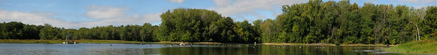
I took what has become my usual route, out the east end of the lagoon, and past Île Gagnon, where the water was extremely shallow, the bottom muddy and rocky, and I was conscious of tucking my tailbone up in anticipation of the grinding beneath. Up the south side of the river, under the Autoroute des Laurentides and the footbridge to Île Locas, checking out the completed swallows nests on the underside as I went - I'd watched the foundations being laid when I was out in June, beakful by beakful of dark river mud, trying to figure out whether one plan ruled construction or not. And then on to the marsh. This post was nearly entitled "500 geese, a dozen herons, and me." This panorama, taken from beside the lookout on the edge of the marsh, should give the idea (note, those speckles are geese).
I let myself drift very slowly through a gap between goose-gangs, and discovered a dredged channel leading into the marsh, which terminated abruptly in a wall of black mud and sticks. I don't think beavers were involved. If they were, no waterway is safe.
As last year, the great blue herons were out of their usual exclusive neighbourhood in the marsh, and scattered up and down the water's edge west of des Laurentides, each one apparently aspiring to solitude. They seemed touchier than usual, and though I wasn't trying to spook them, even when I swung over to the other side of the channel it didn't seem far enough. Though there was the one I came on as I rounded a bend; it froze, I froze, and we played statues as the wind pushed me gently past and away. I also spotted a number of kingfishers dashing between islands, and some small white-bellied shorebirds I could not identify. No swallows, scattered dragonflies, and whatever moved beneath the water's surface was safely hidden in mud. The water-lilies were looking tattered and tired, and there were scattered mats of purple river-plants.
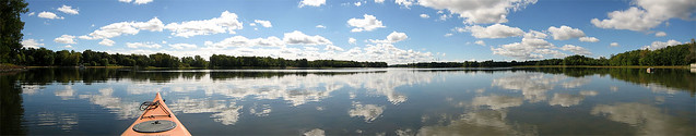
Wind, yes, there was wind, intermittently. But there were spells of calm, allowing full appreciation of the flotillas of round cumuli proceeding overhead with perhaps just a little too much despatch to be stately. This panorama was taken at the furthest west extent of the Parc, at the tip of Île de Mai looking west. One day I shall go beyond ...
I rounded the tip and came down channel between Île de Mai and Laval, brazenly floating down the middle of the channel while munching on a roasted mushroom and chevre panini, something I'd never have dared do in the middle of summer. I paused to admire and take pictures of a weeping willow planted above a wall and draping down almost to the water. While I was doing that, the first power boat of the day passed by, sending the water sloshing and my kayak rocking. Then I swung back over to make a pit-stop on Île Chabon, muttering 'I must do more of this' as I floundered to dismount onto a steeply sloping beach. Two or three canoes had reached the lookout and the geese had scattered. Then I paddled back the way I had come through the channel towards the des Laurentides bridge. I was well into my fourth hour and a day rental, so I paddled around the north side of Île de Jiufs, but had decided to cut myself off at 5 hours and get the 2:30-something bus, so back into the lagoon, which was crowded with single and double kayaks and two person canoes, heading out to enjoy a gorgeous warm afternoon. Would that it had been June!
 My fake GPS plot - just Alison 'taking a line for a walk' as we used to call it in kindergarten. Unfortunately, I can't recall where I got this image from, or I would have updated it to show the difference between then and now.
(But I am not gloating, really, only on this particular day, the east won.)
It was Parc de la Rivière again: Bixi to the Metro, Metro to Cartier station, STM 73 bus in the direction of Fabreville - Laval, bless them, puts the direction of travel on the buses, unlike Montreal. Arrive just after 9 am in noticeably slanted morning light at the Embarcations, and stake my claim on a Kayak de Mer, the doughty orange Kasko.
I'm ashamed to say that I've only paddled the Parc once this summer, back in mid June, the continually taunting weather reports having fed into my third-book-and-trilogy completion neurosis; I kept procrastinating, waiting for a day with no wind forecast. When I was out in June I was impressed by how low the water already was. It made me appreciate that last winter had been dry. Last year in the early summer I was able to paddle through trees (and get munched on by flies), and venture into the marsh; this year, even the turtle pull-outs were well up the bank, the marsh was impassible beyond a short, narrow channel, a number of shortcuts, like the one out of the lagoon in front of the launch site, were above the water level. I'm simply not used to the water going away and not coming back 6 hours or so later. I found myself thinking that the originator of the expression 'letting the grass grow under one's feet' as a measure of indolence had not observed river grass invading an exposed bank. There was no way of telling from the grasses alongside the river that that part was underwater a year ago. Today it was even more of the same. In a lot of places, if I'd tipped, I'd have been sucking mud, and if I'd banged my head on a rock, I might have been rediscovered like Lyuba, the baby mammoth in a million years or so. Although when I did wobble interestingly, it was because I was probing for the bottom with my paddle in what turned out to be a deep spot.
I took what has become my usual route, out the east end of the lagoon, and past Île Gagnon, where the water was extremely shallow, the bottom muddy and rocky, and I was conscious of tucking my tailbone up in anticipation of the grinding beneath. Up the south side of the river, under the Autoroute des Laurentides and the footbridge to Île Locas, checking out the completed swallows nests on the underside as I went - I'd watched the foundations being laid when I was out in June, beakful by beakful of dark river mud, trying to figure out whether one plan ruled construction or not. And then on to the marsh. This post was nearly entitled "500 geese, a dozen herons, and me." This panorama, taken from beside the lookout on the edge of the marsh, should give the idea (note, those speckles are geese).
I let myself drift very slowly through a gap between goose-gangs, and discovered a dredged channel leading into the marsh, which terminated abruptly in a wall of black mud and sticks. I don't think beavers were involved. If they were, no waterway is safe.
As last year, the great blue herons were out of their usual exclusive neighbourhood in the marsh, and scattered up and down the water's edge west of des Laurentides, each one apparently aspiring to solitude. They seemed touchier than usual, and though I wasn't trying to spook them, even when I swung over to the other side of the channel it didn't seem far enough. Though there was the one I came on as I rounded a bend; it froze, I froze, and we played statues as the wind pushed me gently past and away. I also spotted a number of kingfishers dashing between islands, and some small white-bellied shorebirds I could not identify. No swallows, scattered dragonflies, and whatever moved beneath the water's surface was safely hidden in mud. The water-lilies were looking tattered and tired, and there were scattered mats of purple river-plants.
Wind, yes, there was wind, intermittently. But there were spells of calm, allowing full appreciation of the flotillas of round cumuli proceeding overhead with perhaps just a little too much despatch to be stately. This panorama was taken at the furthest west extent of the Parc, at the tip of Île de Mai looking west. One day I shall go beyond ...
I rounded the tip and came down channel between Île de Mai and Laval, brazenly floating down the middle of the channel while munching on a roasted mushroom and chevre panini, something I'd never have dared do in the middle of summer. I paused to admire and take pictures of a weeping willow planted above a wall and draping down almost to the water. While I was doing that, the first power boat of the day passed by, sending the water sloshing and my kayak rocking. Then I swung back over to make a pit-stop on Île Chabon, muttering 'I must do more of this' as I floundered to dismount onto a steeply sloping beach. Two or three canoes had reached the lookout and the geese had scattered. Then I paddled back the way I had come through the channel towards the des Laurentides bridge. I was well into my fourth hour and a day rental, so I paddled around the north side of Île de Jiufs, but had decided to cut myself off at 5 hours and get the 2:30-something bus, so back into the lagoon, which was crowded with single and double kayaks and two person canoes, heading out to enjoy a gorgeous warm afternoon. Would that it had been June!
 My fake GPS plot - just Alison 'taking a line for a walk' as we used to call it in kindergarten. Unfortunately, I can't recall where I got this image from, or I would have updated it to show the difference between then and now.
Thursday, August 04, 2011
Waiatt Bay, Quadra Island
This summer, I got the chance to do something really special. As a volunteer assistant, I joined a biology project. A friend of mine in Straitwatch passed on an appeal from her friend Amy for volunteers to stay at an isolated campsite on Quadra Island, and take samples from beaches. Paddling skills would be an asset.  I joined three other volunteers and Amy for five days on the shores of Waiatt Bay. All these photos were taken by Amy Groesbeck, earlier this summer at similar trips. You won't see any photos of me in this post. You wouldn't want to. The day before the trip, I went to the dermatologist and had eight pink fleshy moles burned off my face with liquid nitrogen. Yuck. A good week to be out in the middle of the woods and the sea, away from most people. It was a good time -- I got on the water every day in small boats, and paddled miles of unfamiliar shorelines.

There's an app for that
Our transportation from Heriot Bay to Waiatt Bay at the north end of Quadra Island was on a boat called the Gung Ho, skippered by Harper Graham. He has a sensible manner that makes passengers feel confident that he knows where he's going and what he's got to do to get there. Of course he knows! On the dashboard in his wheelhouse, next to the throttle controls for the boat's engine and a GPS locator, lies an iPhone in its rubbery case. Yup, an iPhone. He took a text message or two before we finished motoring out of Heriot Bay. He also opened up an app or two and swiped at the phone's screen as he approached the islets in the bay. Perfect navigation. There's an app for that, apparently. The bay is sheltered with several small islands that make up Octopus Islands Marine Park. Though it's only an hour away from Heriot Bay, Waiatt feels really isolated. That's partly because there's only one cabin visible along the shore, and partly because the second-growth timber has gotten pretty thick so the logging clear-cuts are all grown back in.
Here's a photo that Amy took of the place we camped, on the north shore of Waiatt Bay at the place the chart calls "Log Dump." This little cove has a stream running into the bay, and a midden where we camped, all thoroughly stomped on by the logging done here. Two old sheds and a camper are all falling to pieces in the trees. To see lots of photos of how Amy Groesbeck investigates clam gardens, go to her Flickr page and check out the right hand column of photo galleries. Some of them are labelled "Clam Garden 2011 - Trip 1" which took place in April 2011, through Trip 4 which took place in late June 2011. Those are the ones especially clam-appropriate.
All I have is a red canoe, three paddles and the truth(with apologies to U2 and Bono)
The skills to handle small boats are practical skills, with real-life applications for modern work in the sciences. One field that puts canoes and kayaks to serious use is... intertidal biology! At least, it does here on the wet coast.
We set out with two ancient canoes -- one green, one red -- and my five-year-old little inflatable kayak. The photo Amy took shows a dark green boat she used on an earlier trip this summer. The canoes were laden with highly technical scientific sampling equipment. That's 5-gallon plastic pails, garden trowels, rubber-palmed garden gloves, spiral-bound notebooks and Zip-Loc freezer bags. Okay, Amy had a transit of some kind with a laser level, too.
  And here's Amy holding some squares she made, 25 cm on a side made out of 1-inch PVC tubing, so we could dig holes exactly 25 cm across. We had to dig them 30 cm deep, which is exactly the length from my elbow to my knuckles. I love the precision of scientific work! In a few beaches, there were experiments placed where Amy buried hand-made mesh bags holding living clams.
Oh, and I was also trained in how to make a sampling device. A kitchen scrubber called a Tuffy was attached to a ten-inch piece of rebar with a cable tie. Easy as pie. After the rebar was pounded into a clam garden, the Tuffy would sit there for four days, collecting anonymous sludge and (with any luck) clam spat. Apparently, intertidal biologists have been trying to figure out how to collect clam spat, and inventing various devices. Someone lucked into using kitchen scrubbers, and found that the Tuffy brand was particularly effective. Did I mention that this project had some funding from grants? Your tax dollars at work, and very efficiently, too. Why waste a biologist's time hand-knitting spat collecting filters when an affordable commercial alternative is easily available. The fun part is pounding the rebar into the garden, when the pounding has to be done underwater. Smack! Smack! into the water. "Science! Doing it all for science!" Spit out muddy sea water. "I'm still having fun!"
 Dunno what YOU did on your vacation, but I sat on muddy beaches, dug holes, and collected clam spat. I didn't even ask if spat was gametes or zygotes. I wasn't the one picking up the Tuffy scrubbers and putting them in Zip-Loc freezer bags, and I didn't really need to know.
  Nature's Art
On one island owned by a family that Amy knows, there's a cabin, hidden in the trees. It's decorated with all kinds of handmade art objects, made from wood and beach materials and boating materials. Visitors to the bay have been bringing their art objects here for years! When we got back to our camp at the log dump site, I took out my knitting and made a sweater. A little one, doll-size. The next day, we found a piece of driftwood and made a little person to put in the art cabin.

All in all they're just another rock in the wall
 If you look over a clam garden at high tide, whether from a boat or from the shore, you probably wouldn't see anything to tell you that this is a place shaped by human gardeners.
 When the tide is a little lower than full, you might guess at the shallows near shore, usually in a small bay or between two rocky points. But when the tide is low, approaching a zero tide, the clam garden is revealed.
 From shore it looks like a flat, almost level shallow beach. It's mostly free of rocks bigger than your head. Most of the beach is sediments mixed with small stones and bits of broken clam shell. The clam shell hash was added deliberately, to change the local pH of the water and send chemical messages to floating clam spat that here was some good clam habitat to settle down and grow! At the edge of the garden is a rocky ledge. Most of these ledges don't stand up much higher than the level of the beach, maybe ankle-high. But if you look past the edge of the ledge, you can see that the sea bottom drops down suddenly. You're standing at the top of a wall made of rocks piled on rocks.
  One of these walls can be as high as three or four metres or more above its underwater base. Most of the visible rocks look small enough for one person to have rolled down the beach into place, about twenty to thirty centimetres across. The rocks at the bottom of the wall three or four metres or more underwater may be larger, maybe half a metre across or bigger.
  But that's really enough talking that I can do about clam gardens. To learn more about them, check out the totally awesome book Clam Garden by Judith Williams. You can read more about it at the publisher's website. There's a copy in the Greater Victoria Public Library!
A bird in the hand is worth a snake in the shallows
We got to see lots of wildlife, around the shores of Waiatt Bay. My little kayak is so quiet that I could sneak up on these animals, shyer than their city cousins in Cadboro Bay. A few seals swam by to check out our boats. Raccoons like clam gardens! A couple of times we saw two or three raccoons waddling over the flats at low tide, digging for clams and various invertebrates. A mink poked out its head from the shoreline bushes to look at the canoes that had just gone by, then stare at me and squeak "oh crap!" before darting away. And right in our camp, a little brown weasel came scampering by and glared at everyone. For birds, there were ravens watching our every move, as well as kingfishers and a hummingbird, and a large eagle. I'm sure that we all were very glad that no black bears or cougars came by for a visit.
The most striking animal sighting was when Sara squeaked while sitting on a rocky ledge one afternoon. "A snake!" she squawked. A garter snake was sunning itself on the ledge beside her. When it slithered into the lukewarm sea water, our overjoyed amateur naturalists joined the actual biologists. A snake that swam in sea water! oooOOOoo!
Well, maybe the most striking animal was the polychaete, a bristly marine worm that snaked out of a tunnel in the side of the sampling hole that Sara was digging. Another squawk announced her shock at the arrival of the sandworm. This probably wasn't the kind of polychaete that the Kayak Yak paddle group found in Portage Inlet, making jelly ball egg sacs. That worm, according to Dr Kelly Sendal, probably looks rather like a bratwurst. This one in Sara's gloved hands looked more like a giant pink earthworm with tiny millipede legs. She carefully put it aside and went back to digging. And found another one in her next hole. Only a tiny squawk that time. Tough gal!
I love your lab!
The first time we catalogued clams, both living clams and the shells of dead clams, our group gathered under the tarp over our kitchen area. Seated on five-gallon pails, we hunched over our shells. Annemarie sorted shells, Amy and Kim measured shells with calipers, Sarah and I recorded the measurements in Amy's notebooks. Plenty of banter. "Clam me," I said. "All Clams, All Dead." A rain squall fell around us, and we got chilled and stiff before we were done and dinner could be made. The second time was much more idyllic. That afternoon was sunny, so after lunch on a rocky slope below a midden across the bay from camp, we set up the calipers and notebooks. Each of us moved into the shade or sunshine at will by shifting a couple of feet on the moss. Our postures were not hunched this time, but varied from leaning on one elbow like a diner at a Roman feast to laying back against rocky slopes perfectly designed to support our backs and heads. More banter, as living clams were found among the dead samples and a dead clam among the living samples. Zombie clams don't groan "braiiinnzz", we decided, because they don't have brains. They call out for nerves.
 Looking out across the bay was wonderful. I'd always thought that doing science involved wearing lab coats, not bathing suits or my shortie wetsuit. This place was much nicer than a basement lab somewhere. "I love what you've done with your lab!"
In an Octopus's Garden
We came to a clam garden one day that had an unusual living thing at the edge of a particularly high wall. It looked rather like a dahlia flower made out of yellowish jellyfish. "What the heck is that?" Amy wondered out loud. "A squid's egg sac?"
"Or an octopus's egg sac?" I suggested. "There are supposedly a lot of octopus around here. This is Octopus Islands Marine Park, after all." That didn't seem likely. Octopus mothers usually put their egg sacs in sheltered places, and protect them till the little ones hatch. But I found photos online of octopus egg sacs that look pretty much like what we saw.
We got to work taking samples, and Amy wrote notes in her books. When she asked "What shall we call this beach?" there was really only one name to consider: Octopus's Garden.
Here Comes The Rain Again
 The weather was almost perfect -- very little breeze on the water the second day, and a half-hour rain sqall were the only variations from sunny and mild. In this sheltered bay the ocean water gets about as warm as it does anywhere along the coast, so it felt much warmer than where I usually paddle near Victoria. There were some two dozen sailboats anchored in sheltered places around Waiatt Bay, the most crowded that Amy had ever seen this area. Nights were cool but not really cold. And just in case perfect was asking too much, an hour before the Gung Ho returned to take us back to Heriot Bay, the clouds opened up. All our tents were soaked as we stuffed them into their bags. But it was still fun! And I sure hope to do it again next year.
I joined three other volunteers and Amy for five days on the shores of Waiatt Bay. All these photos were taken by Amy Groesbeck, earlier this summer at similar trips. You won't see any photos of me in this post. You wouldn't want to. The day before the trip, I went to the dermatologist and had eight pink fleshy moles burned off my face with liquid nitrogen. Yuck. A good week to be out in the middle of the woods and the sea, away from most people. It was a good time -- I got on the water every day in small boats, and paddled miles of unfamiliar shorelines.
There's an app for that
Our transportation from Heriot Bay to Waiatt Bay at the north end of Quadra Island was on a boat called the Gung Ho, skippered by Harper Graham. He has a sensible manner that makes passengers feel confident that he knows where he's going and what he's got to do to get there. Of course he knows! On the dashboard in his wheelhouse, next to the throttle controls for the boat's engine and a GPS locator, lies an iPhone in its rubbery case. Yup, an iPhone. He took a text message or two before we finished motoring out of Heriot Bay. He also opened up an app or two and swiped at the phone's screen as he approached the islets in the bay. Perfect navigation. There's an app for that, apparently.
The bay is sheltered with several small islands that make up Octopus Islands Marine Park. Though it's only an hour away from Heriot Bay, Waiatt feels really isolated. That's partly because there's only one cabin visible along the shore, and partly because the second-growth timber has gotten pretty thick so the logging clear-cuts are all grown back in.
Here's a photo that Amy took of the place we camped, on the north shore of Waiatt Bay at the place the chart calls "Log Dump." This little cove has a stream running into the bay, and a midden where we camped, all thoroughly stomped on by the logging done here. Two old sheds and a camper are all falling to pieces in the trees.
To see lots of photos of how Amy Groesbeck investigates clam gardens, go to her Flickr page and check out the right hand column of photo galleries. Some of them are labelled "Clam Garden 2011 - Trip 1" which took place in April 2011, through Trip 4 which took place in late June 2011. Those are the ones especially clam-appropriate.
All I have is a red canoe, three paddles and the truth(with apologies to U2 and Bono)
The skills to handle small boats are practical skills, with real-life applications for modern work in the sciences. One field that puts canoes and kayaks to serious use is... intertidal biology! At least, it does here on the wet coast.
We set out with two ancient canoes -- one green, one red -- and my five-year-old little inflatable kayak. The photo Amy took shows a dark green boat she used on an earlier trip this summer. The canoes were laden with highly technical scientific sampling equipment. That's 5-gallon plastic pails, garden trowels, rubber-palmed garden gloves, spiral-bound notebooks and Zip-Loc freezer bags.
Okay, Amy had a transit of some kind with a laser level, too. And here's Amy holding some squares she made, 25 cm on a side made out of 1-inch PVC tubing, so we could dig holes exactly 25 cm across. We had to dig them 30 cm deep, which is exactly the length from my elbow to my knuckles. I love the precision of scientific work! In a few beaches, there were experiments placed where Amy buried hand-made mesh bags holding living clams.
Oh, and I was also trained in how to make a sampling device. A kitchen scrubber called a Tuffy was attached to a ten-inch piece of rebar with a cable tie. Easy as pie. After the rebar was pounded into a clam garden, the Tuffy would sit there for four days, collecting anonymous sludge and (with any luck) clam spat. Apparently, intertidal biologists have been trying to figure out how to collect clam spat, and inventing various devices. Someone lucked into using kitchen scrubbers, and found that the Tuffy brand was particularly effective. Did I mention that this project had some funding from grants? Your tax dollars at work, and very efficiently, too. Why waste a biologist's time hand-knitting spat collecting filters when an affordable commercial alternative is easily available. The fun part is pounding the rebar into the garden, when the pounding has to be done underwater. Smack! Smack! into the water. "Science! Doing it all for science!" Spit out muddy sea water. "I'm still having fun!"
Dunno what YOU did on your vacation, but I sat on muddy beaches, dug holes, and collected clam spat. I didn't even ask if spat was gametes or zygotes. I wasn't the one picking up the Tuffy scrubbers and putting them in Zip-Loc freezer bags, and I didn't really need to know. Nature's Art
On one island owned by a family that Amy knows, there's a cabin, hidden in the trees. It's decorated with all kinds of handmade art objects, made from wood and beach materials and boating materials. Visitors to the bay have been bringing their art objects here for years! When we got back to our camp at the log dump site, I took out my knitting and made a sweater. A little one, doll-size. The next day, we found a piece of driftwood and made a little person to put in the art cabin.
All in all they're just another rock in the wall
If you look over a clam garden at high tide, whether from a boat or from the shore, you probably wouldn't see anything to tell you that this is a place shaped by human gardeners.
When the tide is a little lower than full, you might guess at the shallows near shore, usually in a small bay or between two rocky points. But when the tide is low, approaching a zero tide, the clam garden is revealed.
From shore it looks like a flat, almost level shallow beach. It's mostly free of rocks bigger than your head. Most of the beach is sediments mixed with small stones and bits of broken clam shell. The clam shell hash was added deliberately, to change the local pH of the water and send chemical messages to floating clam spat that here was some good clam habitat to settle down and grow! At the edge of the garden is a rocky ledge. Most of these ledges don't stand up much higher than the level of the beach, maybe ankle-high. But if you look past the edge of the ledge, you can see that the sea bottom drops down suddenly. You're standing at the top of a wall made of rocks piled on rocks. One of these walls can be as high as three or four metres or more above its underwater base. Most of the visible rocks look small enough for one person to have rolled down the beach into place, about twenty to thirty centimetres across. The rocks at the bottom of the wall three or four metres or more underwater may be larger, maybe half a metre across or bigger. But that's really enough talking that I can do about clam gardens. To learn more about them, check out the totally awesome book Clam Garden by Judith Williams. You can read more about it at the publisher's website. There's a copy in the Greater Victoria Public Library!
A bird in the hand is worth a snake in the shallows
We got to see lots of wildlife, around the shores of Waiatt Bay. My little kayak is so quiet that I could sneak up on these animals, shyer than their city cousins in Cadboro Bay. A few seals swam by to check out our boats. Raccoons like clam gardens! A couple of times we saw two or three raccoons waddling over the flats at low tide, digging for clams and various invertebrates. A mink poked out its head from the shoreline bushes to look at the canoes that had just gone by, then stare at me and squeak "oh crap!" before darting away. And right in our camp, a little brown weasel came scampering by and glared at everyone. For birds, there were ravens watching our every move, as well as kingfishers and a hummingbird, and a large eagle. I'm sure that we all were very glad that no black bears or cougars came by for a visit.
The most striking animal sighting was when Sara squeaked while sitting on a rocky ledge one afternoon. "A snake!" she squawked. A garter snake was sunning itself on the ledge beside her. When it slithered into the lukewarm sea water, our overjoyed amateur naturalists joined the actual biologists. A snake that swam in sea water! oooOOOoo!
Well, maybe the most striking animal was the polychaete, a bristly marine worm that snaked out of a tunnel in the side of the sampling hole that Sara was digging. Another squawk announced her shock at the arrival of the sandworm. This probably wasn't the kind of polychaete that the Kayak Yak paddle group found in Portage Inlet, making jelly ball egg sacs. That worm, according to Dr Kelly Sendal, probably looks rather like a bratwurst. This one in Sara's gloved hands looked more like a giant pink earthworm with tiny millipede legs. She carefully put it aside and went back to digging. And found another one in her next hole. Only a tiny squawk that time. Tough gal!
I love your lab!
The first time we catalogued clams, both living clams and the shells of dead clams, our group gathered under the tarp over our kitchen area. Seated on five-gallon pails, we hunched over our shells. Annemarie sorted shells, Amy and Kim measured shells with calipers, Sarah and I recorded the measurements in Amy's notebooks. Plenty of banter. "Clam me," I said. "All Clams, All Dead." A rain squall fell around us, and we got chilled and stiff before we were done and dinner could be made.
The second time was much more idyllic. That afternoon was sunny, so after lunch on a rocky slope below a midden across the bay from camp, we set up the calipers and notebooks. Each of us moved into the shade or sunshine at will by shifting a couple of feet on the moss. Our postures were not hunched this time, but varied from leaning on one elbow like a diner at a Roman feast to laying back against rocky slopes perfectly designed to support our backs and heads. More banter, as living clams were found among the dead samples and a dead clam among the living samples. Zombie clams don't groan "braiiinnzz", we decided, because they don't have brains. They call out for nerves.Looking out across the bay was wonderful. I'd always thought that doing science involved wearing lab coats, not bathing suits or my shortie wetsuit. This place was much nicer than a basement lab somewhere. "I love what you've done with your lab!"
In an Octopus's Garden
We came to a clam garden one day that had an unusual living thing at the edge of a particularly high wall. It looked rather like a dahlia flower made out of yellowish jellyfish. "What the heck is that?" Amy wondered out loud. "A squid's egg sac?"
"Or an octopus's egg sac?" I suggested. "There are supposedly a lot of octopus around here. This is Octopus Islands Marine Park, after all." That didn't seem likely. Octopus mothers usually put their egg sacs in sheltered places, and protect them till the little ones hatch. But I found photos online of octopus egg sacs that look pretty much like what we saw.
We got to work taking samples, and Amy wrote notes in her books. When she asked "What shall we call this beach?" there was really only one name to consider: Octopus's Garden.
Here Comes The Rain Again
The weather was almost perfect -- very little breeze on the water the second day, and a half-hour rain sqall were the only variations from sunny and mild. In this sheltered bay the ocean water gets about as warm as it does anywhere along the coast, so it felt much warmer than where I usually paddle near Victoria. There were some two dozen sailboats anchored in sheltered places around Waiatt Bay, the most crowded that Amy had ever seen this area. Nights were cool but not really cold. And just in case perfect was asking too much, an hour before the Gung Ho returned to take us back to Heriot Bay, the clouds opened up. All our tents were soaked as we stuffed them into their bags. But it was still fun! And I sure hope to do it again next year.
Tuesday, July 01, 2014
River receding. June 22, 2014.
A month after my first foray onto the river for 2014, I was back to see what change time had wrought.
The cherry trees were in full dark leaf, not a blossom to be seen. All the foliage was full and just losing the brilliant emerald of spring. The river had withdrawn from the grass and dropped enough to leave a lip of bank, maybe down about 3-4 feet, although the trees at the edge were still rooted in water.
I paddled up towards the bridge to Île Gagnon, but the current under the bridge still looked brisk, so I decided not to court a dunking quite so early, and turned back, past the launch site and out the Eastern end. Bright blue, cloudless sky, just enough wind to burr the water, water still very brown, silty and opaque. Quite a few kayaks and powerboats out amongst the islands.
I started out by crossing over to the lower part of Île de Juifs, to check whether the channel between Île de Jiufs and Île aux Fraises was still passable; it was, with sufficient attention to the inverted Vs in the water marking rocks. Water was still high enough that the greenery came right down to the water's edge, no bank visible. I paddled west up the channel and out the upstream end, past a spectacular deadfall.
Then west to Île Langlois and across to the south bank and the culvert alongside the Trans-Canada Highway / de Laurentides bridge, which was still passable, though not as much as a month ago. Sheltered, it was still, warm, and scummy, and ruled by red-winged blackbirds. From there I went uneventfully through the tunnel under the Autoroute de Laurentides and steered wide of the people fishing off the embankment to the bridge to Ile Locas. Still a stiff current coming under that bridge, but this time I was prepared for it, and did not get turned around in the eddy. I merely had to work a little. From the other side of the bridge I could see that the platform was once more out near the marsh.
I wanted to check out last month's flooded areas, given the drop in the water level. Île Lacroix had reemerged from the waters and was now fringed with spiky young reeds. A few points along the southern shore were still flooded, and with care I could work my way in amongst the trees and look back out, but the long contiguous passage towards the rear of the marsh that I had explored on my last outing was gone.
The marsh was wide open, with a thin but healthy growth of new reeds sketching in the usual summer limits (my usual panorama shot). I paddled through the reeds and debris, all the way into what later in summer will become an internal pond accessible only by a channel and then as the water drops further, becoming inaccessible. It was windless, with brilliant sunshine sparkling off any flaw in the water, and reeds and foliage perfectly mirrored. The bird watching platform had has been placed on what will probably be edge of the reeds, but right now was far out in the waters. In the still blanched reeds of the northern bank, a unseen heron wheeze-gronked at I don't know what: me? the people on the far bank? passing shadows? her mate? I saw two others in flight around the periphery of the marsh, dark against the emerald trees.
After that, I decided I needed a break, but although there were now several visible steps and a dock at Île Gagnon, there was no beach, and my last attempt at reentry from that dock had ended with me chest deep in warm river for several minutes while I worked out the technique for extracting both feet from the mud. So I circumnavigated the island looking for somewhere I could use as a pull-out that was fairly close to the path, I being in sandals, and not wanting to push my luck after escaping ill-effects from last time's excursions. I found a tree on the water's edge beside the lookout, and I used that as anchor and leverage to help me scramble out onto the slanting, stony, slippery bank. The paths were again paths, rather than canals. I ate my samosas and yoghurt sitting on the bench, and then walked along to the toilet, finding the path up to the toilet shed enthusiastically overgrown. The toilet roll had suffered the depredations of some nest-building critter - the outer layers were shredded, with drifts of small fragments trapped against the base of the shed.
We shall draw a veil over my re-entry. I avoided falling into the water, and I did not lose my sandals, my paddle, or my dignity, although I preserved the latter mainly by making sure no one was within view, and a notable amount of mud came into the cockpit with me.
I was tempted to go back to the marsh for some more photographs, since the sky had begun to fill up with photogenic pebbly white clouds. But there were other places to see. Crossing the main channel from Île des Juifs had convinced me I still did not want to wrestle with the downstream current past Île de Mais (and that I need to get myself into a gym next winter), particularly since a couple of power-boat and aquaskis were already tearing up the main channel. I headed across to the far side of the river to check out road bridge linking Île Morris and then the Pont Gédeon-Ouimet (the one I keep thinking of de Laurentides) for swallow's nests. I caught a glimpse of one or two birds, but the nests I saw were few, old and empty. I only spotted two families of ducklings, one quite mature, and one younger, although I saw very few female mallards.
With the water still high, I could work my way up the channel between Île Lefebvre and Île Morris, through mats of water-lilies and around stands of broken reeds, to the columns supporting the motorway bridge, which rested on mud and just enough water to float a kayak. Something is preying on the water-lily leaves: many of them were yellow, with concentric curving cuts, like paper art (there's a word, but that neuron is just not letting go). On the far side of the motorway bridge, beyond the water, was the rusted relic of an older bridge, one that looked more like a railway bridge than a roadway bridge. From there, I could look eastwards down the channel towards Île Saint-Mars and Île des Lys. As I cleared the reeds nearest the bridge, a flurry of splashing broke out behind me, repeated at intervals in an uneven circuit around the edge of the reeds, with flashes of scale and and fin and slaps on the water. I could track it … whatever it was … by the irregular motions of the reeds. My foremost hypothesis that one of the huge river carp was trying to eat something large and uncooperative - and I was torn between holding the paddle and or the camera, but as the disturbance began working its way towards me, I opted for the paddle, and a slow retreat. Top predator or not, I didn't want that brawl exploding under my keel.
All went quiet for a little while, until something splashed off a fallen log against the shore of Île Lefebvre. I expected to see a muskrat or a maybe even a beaver swimming away, but all I saw was the same pattern of twitching leaves and thrashing headed up towards the bridge. It dawned upon me that I was seeing the big fish brute-forcing their way through the obstacles of reeds and shallows. I tracked a third set of twitching reeds and ripples upstream on a similar transit to the second, during which a broad scaly back broke the surface and unfurled a dorsal fin the size of my five fingers. The closest I knowingly came to one of them was when my brain belatedly caught up with my eyes as I slid my paddle down between lily pads onto a long shadow. I don't know which was more startled, the fish or I.
I then crossed over to explore a section of the riverbank accessible from the shore by a raised walkway, which was still flooded enough to let me through into what must later in summer be a pasture. The water was shallow, still, clear, and noticeably amber, but clean enough to support an abundance of tiny fish, and the occasional larger one, passing through. And turtles. While I was on the landward side, a heron dropped in alongside my exit channel, but I was saved from the decision as to when to disturb it by a quartet of my fellow humans, tramping down the walkway. Not sure whether they even noticed the bird. I spread out my map on my deck to figure out where to go next, and took a panorama shot from the shade of the forest.
Since I'd been playing the 'I'll get the next bus' game with myself for two hours by then, I ducked down behind Île Ducharme to check its bridge for nests - no - and its pullouts for turtles - also no - although I was pleased to see one small house in particular restored from the damage it had suffered during a severe thunderstorm last July. Since I wanted to go under the bridge into the lagoon with the current, that then meant I had to go upstream and around the top of Ile Gagnon, which I did, again via the channel between Ile des Juifs and Ile aux Fraises, and then crossed the channel (and the current) west of Ile Chapleau and Ile Kennedy, took a panorama looking west from Ile Gagnon, and then paddled around the upstream side of Ile Gagnon and raced two kayaks and two canoes to the bridge (I came second). I was trying to get ahead of them in the queue, to make sure I caught my bus - the 1441 73 to Cartier. Despite a few suspenseful moments when it seemed the quartet in front would never focus on the task at hand, I did.
Sunday, August 05, 2007
The Magnificent Seven
Finally, a bright sunny day for a paddle! We decided to make another try for Discovery Island.
We launched avoiding this angry-looking jellyfish.
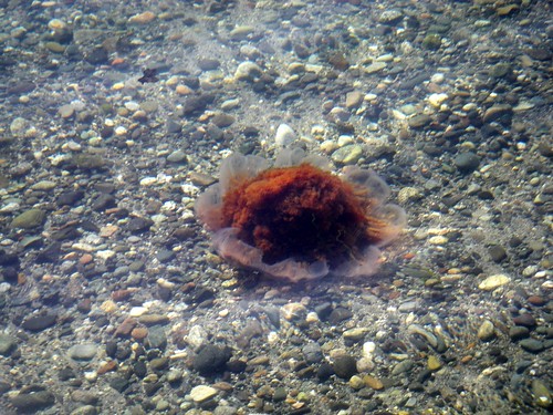
It was a big group today: Louise, Tracey, Paula, Bernie, Dennis, Alison and myself. Seven of us on a magnificent day. To the south there was a off-shore fog bank that we wearily watched for a while, but it dissipated quickly and we had nothing but sunny skies.
We paddled towards the Chain Islands where we would turn and head towards Discovery Island. It was a flattish calm to begin with, but soon we were into some light chop,
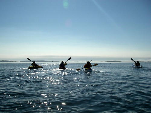
One thing we discovered is that with a lot of paddlers we easily broke up into two groups: the Slow-Pokes and the Speed-Demons. And when the Speed-Demons stopped for a rest, they took off as soon as the Slow-Pokes caught up! Hey, Slow-Pokes need a break, too!
Oops. Someone forgot to tell Bernie that it was not bump-to-pass.
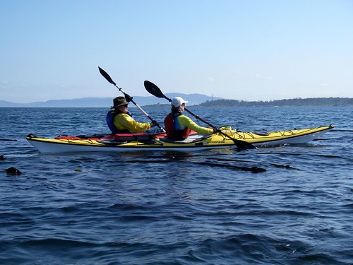
When we got to the Chains, the Speed-Demons burned on through, leaving little chance for me to take many pictures. But I did get a few.

Off in the distance, big freighters were passing. As we neared Discovery, a wake from one of these ships came roaring onto us. I could tell that there was danger because Bernie had turned out and was heading straight for it. I could see a large breaker rolling in and knew this could be fun.

And fun it was. By the time it reached us it was a series of long deep swells. I had my hands full keeping my boat straight but I decided to try and snap off a shot of Alison who was on my left. It's not a great shot -- I really wasn't aiming, just pointing and praying -- but you will notice Alison's head and paddle just disappearing behind the wave's crest.
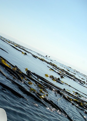
We put in at Discovery for some munchies.
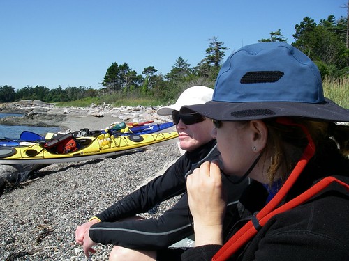
This was Alison's first time to Discovery. Here's her hero shot.
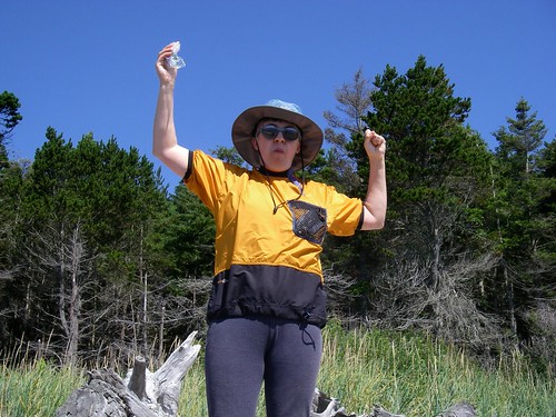
We decided to go around Discovery and shoved off again. This guy wasn't sorry to see us go.
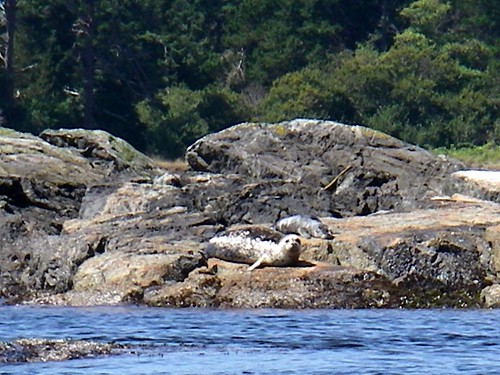
Tracy leads the way.
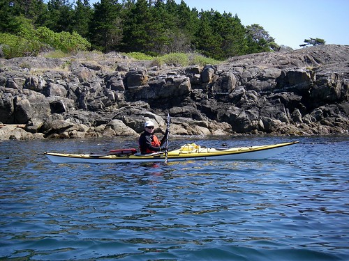
Dennis slips between some rocks.
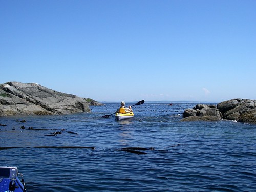
We paddled down the passage between Discovery on the left and Chatham Island on the right.

This guy was hanging out enjoying the day.
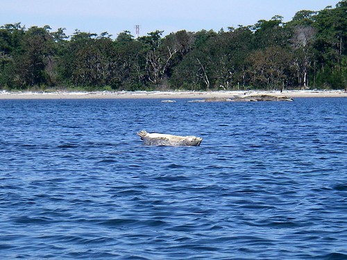
When we cleared the passage and began the return crossing towards the Chains Islands, we were into some unexpectedly bumpy water. When we got to the Chains, we saw that the current between the Chains and the small lighthouse was worse.

But we pressed on. We didn't have a choice really.
In the lee of the lighthouse, we saw that the final crossing was even worse: large breaking waves and fast currents. Lots of rough and confused water. Our comfort levels were being challenged. These currents were a real surprise and a puzzle -- the tide chart indicated a slow incoming tide, yet we were facing strong outflow currents! The good news was that the section we needed to cross was perhaps only a few hundred yards wide, but it was going to be an interesting few hundred yards! Then Bernie started cackling and headed off into the current. We knew from past experience that if Bernie was cackling, we were in trouble.
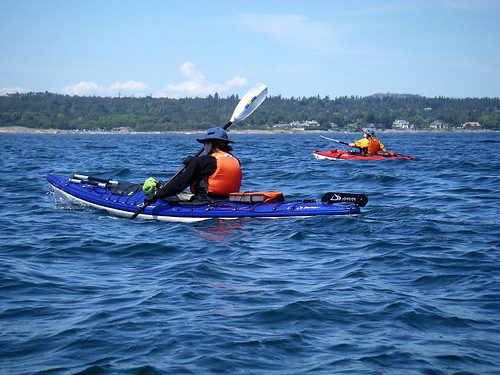
Paula and I were the last in line. As Bernie went by, laughing like the mad man he is, we entered the current. No pictures exist of the final crossing. My bow camera was swept off my deck (I did recover it), and my hands were too busy to take any pictures with my other cameras. Even though Paula and I were together when we entered the current, we were quickly separated, a sober fact to consider if someone had gone over -- how would anyone have gotten close enough to help?
It was rough, and my kayak was getting pushed around a little. I tried to keep it pointed into the waves but it didn't always work. At one point I rode up a wave broadside and it broke over my deck. That was A Moment.
We all got through. I was at the end of the line and did a quick head count - seven paddlers up.
But we weren't totally unscathed. Louise's stomach got the better of her after we got out of the really rough stuff and she blew her whistle. Our first whistle emergency. Paula, Alison and I hustled over. She was okay, just a little woozey, and she made it back to shore under her own power. Everyone beached safely.
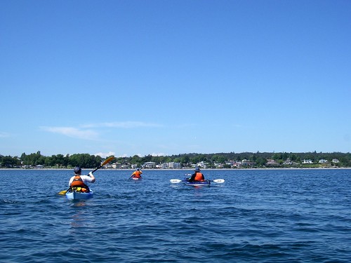
So what happened? The biggest mistake we made today was that we were relying solely on the tide charts to forecast the currents. At the time of our return crossing, they indicated a slow incoming tide, almost slack. Had we consulted the current tables, we would have seen a forecast for exactly what we experienced -- a 2 and a half knot outflowing current. A strong outflow current on an incoming tide seems counter-intuitive, but the currents can play nasty tricks on paddlers on the West Coast. Because of the many islands in the straits, you can end up with a current exactly opposite from the tide tables would indicate. That's how the currents work around here. We forgot.
Thus endeth the lesson.
John's photos are here.
We launched avoiding this angry-looking jellyfish.
It was a big group today: Louise, Tracey, Paula, Bernie, Dennis, Alison and myself. Seven of us on a magnificent day. To the south there was a off-shore fog bank that we wearily watched for a while, but it dissipated quickly and we had nothing but sunny skies.
We paddled towards the Chain Islands where we would turn and head towards Discovery Island. It was a flattish calm to begin with, but soon we were into some light chop,
One thing we discovered is that with a lot of paddlers we easily broke up into two groups: the Slow-Pokes and the Speed-Demons. And when the Speed-Demons stopped for a rest, they took off as soon as the Slow-Pokes caught up! Hey, Slow-Pokes need a break, too!
Oops. Someone forgot to tell Bernie that it was not bump-to-pass.
When we got to the Chains, the Speed-Demons burned on through, leaving little chance for me to take many pictures. But I did get a few.
Off in the distance, big freighters were passing. As we neared Discovery, a wake from one of these ships came roaring onto us. I could tell that there was danger because Bernie had turned out and was heading straight for it. I could see a large breaker rolling in and knew this could be fun.
And fun it was. By the time it reached us it was a series of long deep swells. I had my hands full keeping my boat straight but I decided to try and snap off a shot of Alison who was on my left. It's not a great shot -- I really wasn't aiming, just pointing and praying -- but you will notice Alison's head and paddle just disappearing behind the wave's crest.
We put in at Discovery for some munchies.
This was Alison's first time to Discovery. Here's her hero shot.
We decided to go around Discovery and shoved off again. This guy wasn't sorry to see us go.
Tracy leads the way.
Dennis slips between some rocks.
We paddled down the passage between Discovery on the left and Chatham Island on the right.
This guy was hanging out enjoying the day.
When we cleared the passage and began the return crossing towards the Chains Islands, we were into some unexpectedly bumpy water. When we got to the Chains, we saw that the current between the Chains and the small lighthouse was worse.
But we pressed on. We didn't have a choice really.
In the lee of the lighthouse, we saw that the final crossing was even worse: large breaking waves and fast currents. Lots of rough and confused water. Our comfort levels were being challenged. These currents were a real surprise and a puzzle -- the tide chart indicated a slow incoming tide, yet we were facing strong outflow currents! The good news was that the section we needed to cross was perhaps only a few hundred yards wide, but it was going to be an interesting few hundred yards! Then Bernie started cackling and headed off into the current. We knew from past experience that if Bernie was cackling, we were in trouble.
Paula and I were the last in line. As Bernie went by, laughing like the mad man he is, we entered the current. No pictures exist of the final crossing. My bow camera was swept off my deck (I did recover it), and my hands were too busy to take any pictures with my other cameras. Even though Paula and I were together when we entered the current, we were quickly separated, a sober fact to consider if someone had gone over -- how would anyone have gotten close enough to help?
It was rough, and my kayak was getting pushed around a little. I tried to keep it pointed into the waves but it didn't always work. At one point I rode up a wave broadside and it broke over my deck. That was A Moment.
We all got through. I was at the end of the line and did a quick head count - seven paddlers up.
But we weren't totally unscathed. Louise's stomach got the better of her after we got out of the really rough stuff and she blew her whistle. Our first whistle emergency. Paula, Alison and I hustled over. She was okay, just a little woozey, and she made it back to shore under her own power. Everyone beached safely.
So what happened? The biggest mistake we made today was that we were relying solely on the tide charts to forecast the currents. At the time of our return crossing, they indicated a slow incoming tide, almost slack. Had we consulted the current tables, we would have seen a forecast for exactly what we experienced -- a 2 and a half knot outflowing current. A strong outflow current on an incoming tide seems counter-intuitive, but the currents can play nasty tricks on paddlers on the West Coast. Because of the many islands in the straits, you can end up with a current exactly opposite from the tide tables would indicate. That's how the currents work around here. We forgot.
Thus endeth the lesson.
John's photos are here.
Saturday, February 24, 2007
Paddle Saanich Inlet
Saanich Inlet:
Coles Bay, Brentwood Bay, Bamberton, Tod Inlet, and Squally Reach
Use Chart 3462 Juan De Fuca St. To St. Of Georgia or
Chart 3313 Tsehum Harbour to Ladysmith Harbour (supersedes #3310)
Saanich Inlet stretches from Deep Cove in the north down to the entrance to Goldstream Park in the south, and dropping over 100 metres below you. The main area out of Brentwood Bay comprises some of the most beautiful and protected paddling areas, and some of the worst excesses of the local land developers.
Access is usually from the east, leading you into areas like Coles Bay and Brentwood Bay. Coles Bay has public access to the beach through a park, which is nice because there is longer term parking, but requires hauling your boat(s) a long way (better part of a kilometre?) down a narrow path. Once at the water, the tide defines whether the launch will be easy or difficult, as the high water makes launching…crowded.
The waters out of Coles Bay are beautiful and clear, with a scoured rock bottom mostly unobstructed by, well, anything. Patches of plant growth, but mostly white smooth rock. The bay itself is quite shallow and protected , with a southern exposure. On the north end at the mouth of the bay is Yarrow point and Dyer Rocks, which make for a good place to get an impression of conditions in the inlet proper.
Our paddling has been exclusively to the south of the bay, heading down the shore towards Thompson Cove and Brentwood Bay. Saanich Inlet is close to two nautical miles across at this point, and one could cross from Coles Bay on the east side of the inlet, to Mill Bay on the west side. Mill Bay marks the western embarkation point for the Brentwood Bay ferry, and doesn’t offer a lot of on-shore inducements to the paddler. Paddling down the east side of the inlet offers stunning views, with the Malahat running along the crest of the first hump of mountain out of the water.
Coles Bay has a wide opening into Saanich Inlet, and the shoreline continues around a long curve to Thomson Cove and Henderson Point. Just south and west of Henderson is Senanus Island, part of the Senanus First Nations territory.
The island is a great place to paddle around; relatively isolated even though it is so near so many people, the island is a great place for watching wildlife. Seals feed in the waters around the island and sunbathe on its rocks (remember, the rule is to stay 100 metres away from seals—particularly during the spring and early summer when they’ve just pupped). And the water is clear and relatively shallow, making it a good place for undersea life watching. A myriad of sea stars, crabs and fish can be seen amongst the eelgrass and kelp. But the island itself is First Nations territory, so landing is not on.
If you come out on Keating Cross road to West Saanich Road, and turn onto Verdier Ave, you find at the end of the avenue the Brentwood Bay Ferry, which travels between here and Mill Bay on the northwest side of Saanich Inlet. As kayakers, it’s a good idea to keep an eye out for the ferry because to it we aren’t much more than speed bumps. Between the ferry terminal and Brentwood Bay Inn and Spa is a small park and sidewalk that leads down to the docks and to the public beach (what little is left of it). Remember that parking here is limited and restricted to two hours. And don’t park in the ferry worker’s spots! Brentwood Bay Inn rents kayaks to the public, if you find yourself needing a boat, or you can launch your own from the public beach. The public beach does have a tendency to disappear at high tide, so it is important to time your launch and return.
If you launch from Brentwood Bay, the trip across the inlet to Bamberton is about 4.5 kilometres or over to Senanus Island is about 2.2 kilometres. An alternative to these trips is to more or less follow the shore to the south and head past Daphne Islet and into Tod Inlet about a kilometre from the launch point.
Tod inlet is a part of the Gowlland Tod park and extends roughly a kilometre and a half. The waters here are extremely protected, and quite shallow. Used to moor boats (mostly sail), it’s also home to a lot of different wildlife. We’ve seen eagles feeding on ducks, ducks feeding on fingerlings, sea stars feeding on whatever they feed on, oysters, crabs, cormorants, herons, and plenty more wildlife of various kinds.
At the far end is a small dock and a couple of picnic tables, making this a great place to take a break and maybe a walk. A trip up Tod Inlet is beautiful, relaxing, and easy on the paddler. Definitely a must do—especially for the novice paddler.
For the more adventurous, heading out from Brentwood Bay to Bamberton is a good start. Heading slightly south to Willis Point is a good idea, as it lets you check conditions before heading across. You can shorten the distance across Squally Reach by heading from Willis Point south and then across to either Sheppard Point (1.5 km) or McCurdy Point (1 km). But be warned, Squally Reach is well named, and winds seem to channel down the mountains and into the reach, making conditions a bit treacherous on occasion.
The shoreline, particularly on the west side of the inlet, rises steeply out of the water, making it difficult to find places to beach your boat and have a look around. There is a pullout just on the north side of Bamberton and the B.C. Cement pit, but that’s about it. The rest of the way from McCurdy Point to Bamberton is mostly rocks and coves full of rocks. Great for the seals—they have several haul outs and feeding areas along this stretch—but not so great if you need to pull in. But we have met paddlers from Cowichan Bay (20 kilometres to the north) paddling down the inlet to Finlayson Arm. A major all-day paddle; we were such wankers compared to them.
Another put in can be found at the bottom of Marchant Road in Brentwood Bay. There’s a public wharf, but t isn’t suitable for kayakers. Instead you have to descend a steep flight of concrete stairs to a public beach that, again, disappears at high tide. But, on the plus side, both public beaches have nearby restaurants—a definite plus after a day of paddling.
Subscribe to:
Posts (Atom)