There are some astounding scenes of flooding from the American east coast playing out over the airwaves right now thanks to the rains brought by hurricane Irene, but here's a small snippet of kayak-related heroics courtesy of The Burlington Free Press in Vermont. Don't know much more about this other than the obvious: someone used a kayak to rescue stranded farm animals.
Until I stumbled onto this picture, I'd utterly forgotten that I'd been to Burlington. Mind you, it was 40 years ago and I was only there for a couple of hours, so I hope I'm forgiven the memory lapse. My family had rented a cottage on Lake Champlain (the Québec side) and we hopped over the border for day trips to Plattsburgh, New York and to Burlington. I don't remember much except the lush forest and the Lake. Beautiful country. Here's hoping the area bounces back soon.
Tuesday, August 30, 2011
Monday, August 29, 2011
Meanwhile, here in Montréal

. . . it was not a kayaking day.

We caught the trailing edge. Cumulative rainfall was 56.4 mm over about 12 hours of August 28, with an additional 1.6 mm on August 29. Compared to some of the totals to the east of us, that was modest, and Environment Canada never did grant us more than "light rain" on our hourly assessments. Wind speeds fell short of the 90 kph on our wind warning, though they were impressive enough (see below). I don't have the corresponding hourly rainfall data, or that would be on there too. Temperature started around 20 and gradually drifted down to 13/14C. I missed checking the wind and rainfall records for August 28 on the day itself, and haven't yet found my way into that particular archive.
The force of the storm was much more palpable towards the east of us: much more rain, more wind, more damage, and, unfortunately, loss of life.

Kayakers gained an unwelcome notoriety thanks to a couple of NY paddlers who had to be plucked from the bounding main by the New York harbour patrol on Saturday morning. NY Mayor Bloomberg was not impressed.
On the other hand, as the skies cleared, people have been discovering how useful a kayak can be, in certain extreme circumstances.
Which I hope we won't see again, for a long while.
Testing Stuff!
Stuff arrived by courier this week. It was a package sent by Icebreaker, with a pair of their Legless merino wool leggings for me to test and write about. Yay!
These Legless tights are the Pace version, meant for runners to wear alone or under light trousers. Other versions of Legless tights are winter underwear meant to leave shins & ankles free from excessive layering with socks & trousers. They're capri length, to about mid-calf on the model on their website. (Full disclosure: I am NOT the model on the Icebreaker.com website. I do not look even remotely like the model wearing the Legless tights, Pace version. I have the finely-honed body of a freelance writer.)
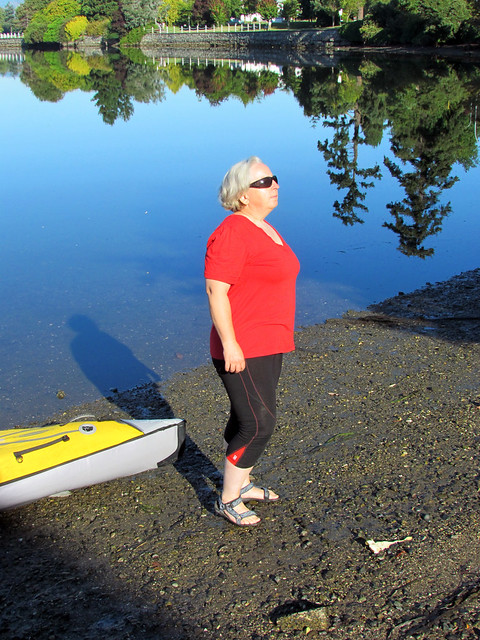

One of my theories about clothing for kayakers is that "dress for immersion" doesn't always have to mean "wear a wetsuit" or "wear a dry suit." It can also mean "wear something I can swim in" where swimming is safe. On hot summer days when we're practising our wet exits at a sheltered lake, I wear a bathing suit or shorts and a t-shirt. But most days, I'm not planning to swim. When I'm kayaking in sheltered, familiar waters and staying close to shore, dressing for immersion means I wear a light merino wool shirt and leggings. In the cold ocean water, I'd be able to swim a few yards to shore.
But my old leggings wore out. And when I wrote to Icebreaker praising the many-mended leggings and shirts that I wear while paddling, they sent me a new pair of leggings to try.
Lemme say, the Legless are pretty much exactly what I'm looking for in paddling pants. They're short enough that I can wade and get into my boat. They dry quickly when splashed. They're warm when wet, something that polyester tights and bike shorts are NOT.
Another factor that works for me is that these tights look like summery, sporty clothes. When commando kayaking I like to be able to wear my paddling clothes on the bus without causing panic and a general exodus via the back door. I wore these tights with a long t-shirt and a long sweater on campus and at the library. (Don't panic. I have permission from my fashionistas Lila, Ben and Marlene, provided that the shirt is long enough to cover the rump.) The verdict from several consultants was that the look was "slimming." Nice thought.
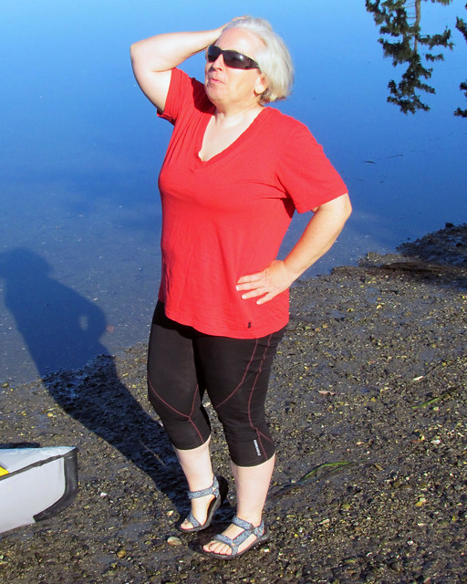

We've been in a bit of a heat wave, and I wore these tights not only while kayaking, but while gardening and walking over a mile on pavement in the baking hot sunshine. In spite of being made of black wool, these tights were cooler than a similar pair of polyester tights.
For people unfamiliar with wearing wool as anything other than a bulky sweater, I can confirm that like other light merino wool garments, Legless tights can be thrown in the washing machine. (Cold water wash, and any other clothes in the load should not be "shedding" lots of fluff.) For drying, hang 'em up. They dry pretty quickly.
The only problem for me is that the promotional ad photos Icebreaker puts on its website are a little weird. Not the photos showing the garments worn by models... those are ok though all the models are young and trim. (Would it be so wrong to have a plump model staying healthy and active in sports gear?) No, it's the flashy promotional photos on Icebreaker's website that are kinda weird. A dark man with a ram's head. A woman riding him. I'm up for images of strength and vigor, but some of these photos look heterosexist and creepy. Not creepy enough to keep me from wearing these merino wool tights and my mended shirts!
The only problem for me is that the promotional ad photos Icebreaker puts on its website are a little weird. Not the photos showing the garments worn by models... those are ok though all the models are young and trim. (Would it be so wrong to have a plump model staying healthy and active in sports gear?) No, it's the flashy promotional photos on Icebreaker's website that are kinda weird. A dark man with a ram's head. A woman riding him. I'm up for images of strength and vigor, but some of these photos look heterosexist and creepy. Not creepy enough to keep me from wearing these merino wool tights and my mended shirts!
Sunday, August 28, 2011
Roly Poly Fish Heads. Eat Them Up. Yum.
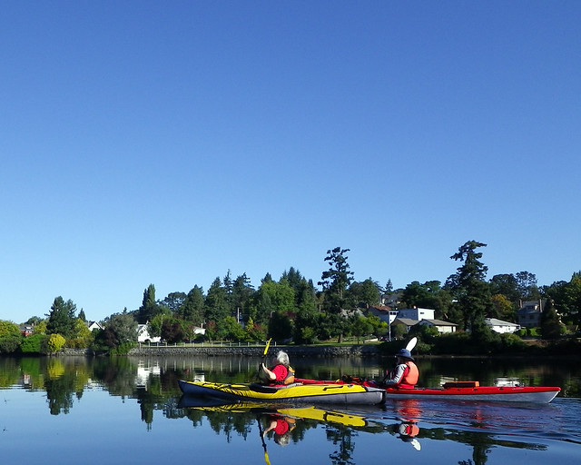
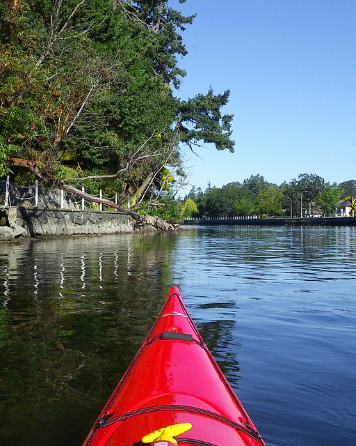
So let's be clear about this. I don't do hot. And as we head into the last weekend of August, we've experiencing our first real long stretch of summer weather, and after weeks of complaining about it being too cool and too cloudy, now it's too bright and too hot. I'm thinking of changing my names to Goldilocks. On this hot Sunday we had no real desire to wrap ourselves up in a drysuit or neoprene, or to be broiled outside during the forecast blaze of midday, so we went for an early morning quickie up the Gorge. Of course, before we began, we had our traditional pre-paddle round of charades. Today's topic was music albums, and Paula and Louise did their best impression of Devo's New Traditionalists cover.
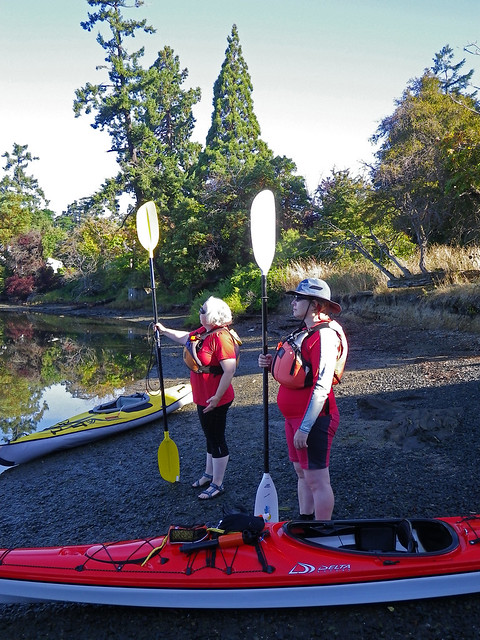
Paula, in her Advanced Elements inflatable joined Louise and I in our Deltas and we headed out into the windless morning.
It wasn't long until we kayaked by this seagull who clearly was having trouble eating his breakfast.
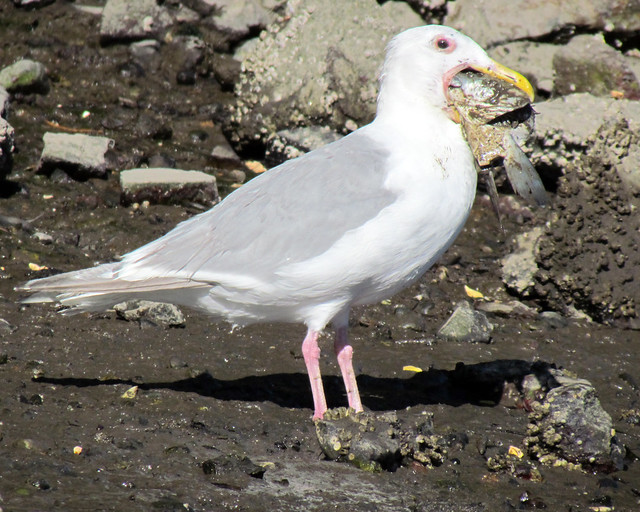
That fish head is bigger than his head! Clearly this violate the B.Kliban rule.
From there, we meandered in to Portage Inlet....
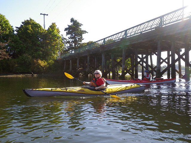
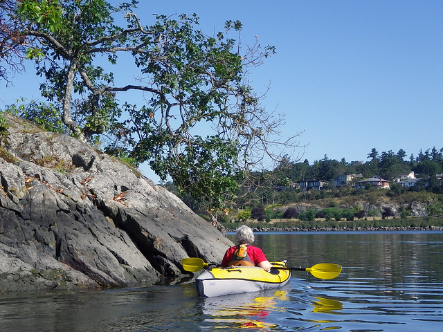
...but we were soon reminded that even under such benign conditions and so close to home, you're still on the water, and medical emergencies, even minor ones, suddenly become a whole extra level of difficult. One of Louise's eyes started burning, and she couldn't keep it open.
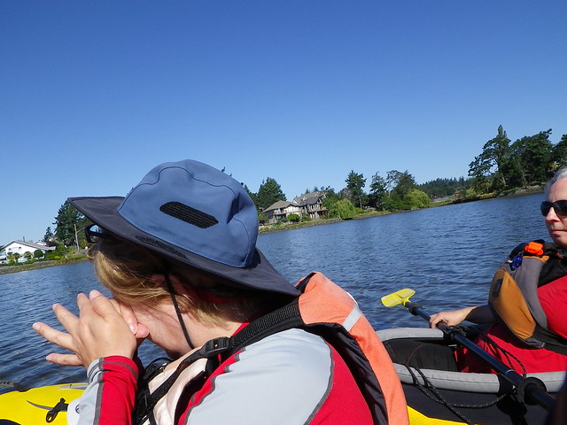
Paula and I came along side and we helped flush her eye. Fortunately we had plenty of water with us. We suspect that a ball of sweat rolled down her face and took some sunscreen along for the ride into her eye. She didn't seem to have anything in it, and it was only slightly red. A few washings and she was able to continue, but we decided to head back.
As we headed back, we saw the local swans. We didn't get to see the baby swans this year, so we're not sure how many babies they started with, but at least one made it near-adulthood, and that's a good thing.
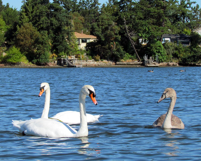
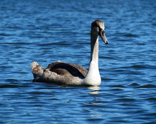
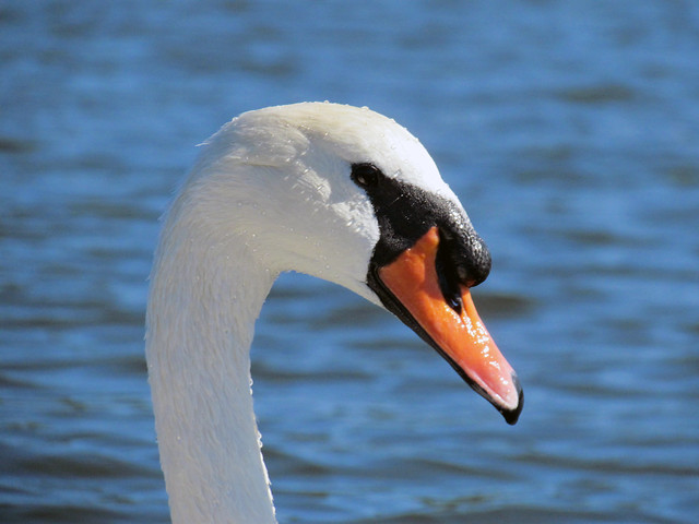
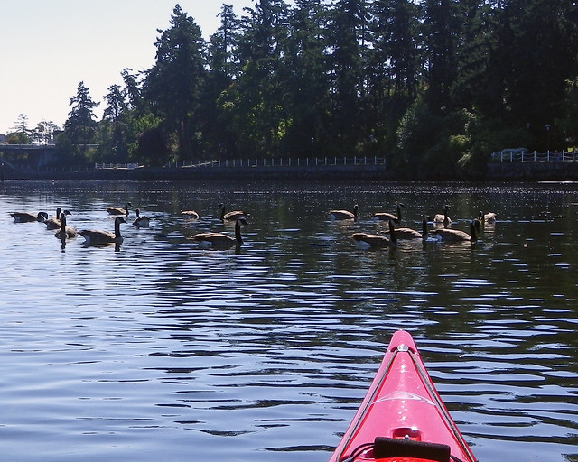
We ran one final gauntlet of geese and we were done.
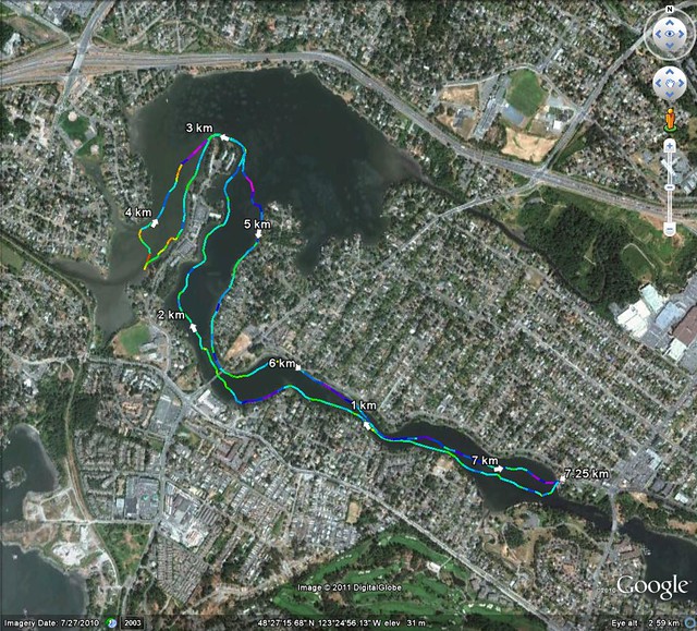
Trip Length: 7.25 km
YTD: 187.38 km
More pictures are here.
It has come to my attention that Louise somehow escaped her formative years without being exposed to the song Fish Heads by Barnes and Barnes, and thus had no pop-cultural reference for the blog post title. Just a blank stare that seemed to say, "What kind of crazy are you now?" I get that a lot.
It seems inconceivable to me that someone as literate and well-educated as Louise could have gone this far in life without hearing this song. Clearly, those noisy right-wingers must be correct about the state of our education system!
To rectify that, here's Barnes and Barnes' website. And for all you trivia masters out there, one half of Barnes and Barnes is actor Bill Mumy who played Will Robinson on the original Lost in Space and Lennier on Babylon 5! Who says you don't learn anything in the blogisphere!
At least I didn't have to explain who Devo is.

Paula, in her Advanced Elements inflatable joined Louise and I in our Deltas and we headed out into the windless morning.


It wasn't long until we kayaked by this seagull who clearly was having trouble eating his breakfast.

That fish head is bigger than his head! Clearly this violate the B.Kliban rule.
From there, we meandered in to Portage Inlet....


...but we were soon reminded that even under such benign conditions and so close to home, you're still on the water, and medical emergencies, even minor ones, suddenly become a whole extra level of difficult. One of Louise's eyes started burning, and she couldn't keep it open.

Paula and I came along side and we helped flush her eye. Fortunately we had plenty of water with us. We suspect that a ball of sweat rolled down her face and took some sunscreen along for the ride into her eye. She didn't seem to have anything in it, and it was only slightly red. A few washings and she was able to continue, but we decided to head back.
As we headed back, we saw the local swans. We didn't get to see the baby swans this year, so we're not sure how many babies they started with, but at least one made it near-adulthood, and that's a good thing.


We ran one final gauntlet of geese and we were done.

Trip Length: 7.25 km
YTD: 187.38 km
More pictures are here.
It has come to my attention that Louise somehow escaped her formative years without being exposed to the song Fish Heads by Barnes and Barnes, and thus had no pop-cultural reference for the blog post title. Just a blank stare that seemed to say, "What kind of crazy are you now?" I get that a lot.
It seems inconceivable to me that someone as literate and well-educated as Louise could have gone this far in life without hearing this song. Clearly, those noisy right-wingers must be correct about the state of our education system!
To rectify that, here's Barnes and Barnes' website. And for all you trivia masters out there, one half of Barnes and Barnes is actor Bill Mumy who played Will Robinson on the original Lost in Space and Lennier on Babylon 5! Who says you don't learn anything in the blogisphere!
At least I didn't have to explain who Devo is.

Monday, August 22, 2011
GINPR Public Sessions
Got a note today from Carolyn Stewart, one of the staff who manage the Gulf Islands National Park Reserve (GINPR).
No, that's not the name of a dwarf from a Tolkien novel! It's the name of the national park spread out on all those little scattered islands that we like to paddle among. Dunno about you, but I plan to visit new places among those little park-lets, and maybe camp on Saturna next summer.
At any rate, their public sessions are coming up in September. Local paddlers should try to drop by or at least send some comments, ok? Her contact info is below.
Carolyn's note says:
In Victoria, we will have park/management plan information booth & display at The Bay Centre in downtown Victoria (1150 Douglas St, 2nd floor) on Thursday, September 15 from 11am -2pm.
In Sidney, we will have an afternoon, open house at the Mary Winspear Centre (2243 Beacon Ave, Rm 2) on Saturday, October 1 from 1pm - 3pm.
Please drop by and provide your ideas and comments on the phase 1 aspects for the management plan. If you cannot make it, please be sure and provide your comments by email, mail or fax.
Carolyn Stewart
Park and Community Planning Coordinator / Coordonnatrice, parc et planification urbaine
Parks Canada / Parcs Canada
Coastal BC Field Unit / Unité de gestion de la Côte de la C.B.
2220 Harbour Road / 2220 chemin Harbour
Sidney, BC / C.B. V8L 2P6
carolyn.stewart@pc.gc.ca
Tel / Tél: 250-654-4012
Toll free / sans frais: 1-866-944-1744
Fax / Télécopieur: 250-654-4014
www.pc.gc.ca/gulf
Wednesday, August 17, 2011
Stuff!
We didn't paddle as a group this weekend. (I don't count the times I get out on the bay by myself as an "outing" -- just like John and Louise don't count going for a run or brisk walk along the Gorge, or Bernie doesn't get out his bike when he's "only" walking a mile to the public library and then back.) It was a 'check on the aging parents' weekend in which J and L checked on their moms, we checked on my folks and Bernie called his dad, and our son phoned Bernie to wish him a happy birthday. I guess that makes us the aging parents being checked on, too... coffee at Olive Olio's instead of paddling, sheesh.
Besides, John's get up and go got up and went. Stephanie thinks she saw it at 6:30 am when she was checking on her chickens, and it was speeding down the road honking with delight. Brian says it ran past him at the car show in Oak Bay, pantless. I can confirm that. After coffee I fiddled in my garden plot on campus then hopped on a bus and hopped off to walk along Bowker Creek to the Monterey Rec Centre. We'd just been talking over coffee about the Bowker Creek watershed, and how the creek runs from UVic down to Shelbourne Street and wanders around before getting to Willows Beach, so it was nice to see some of the restoration going on along this creek. As I walked, I could hear music. The source was the classic car show on Oak Bay Avenue, and there was John's get up and go, having more fun than he was that morning. It was sitting in someone's restored Triumph, polishing the lovely chrome. He's really got to keep a better handle on his get up and go, or at least make it wear pants.
Eventually, I walked back to a convenient bus stop and knitted my way home. Checked my e-mail and abruptly felt less decrepit to find an e-mail back from ICEBREAKER! The folks who make Icebreaker merino wool clothing were really pleased to hear from me about wearing clothes they made during my trip to be a volunteer clam researcher at Waiatt Bay on Quadra Island. They're sending me a pair of merino wool leggings (the foot-less, calf-length kind called Legless) to wear and test for them. I think Legless will be good to wear while commando kayaking... anything I can wear both on the bus and in my kayak sounds good for keeping my gear bag small.
All Icebreaker wants is for me to sign up for their e-mail newsletter. Well, that seems like a good idea. I went to their link and checked it out. Turns out, people who sign up for their newsletter have a tree planted in their name, and get entered in a draw for a free top. Sounds pretty good.
Monday, August 15, 2011
Local Kayak Expedition From Prince Rupert Wraps Up
A group of students attending Pearson College in nearby Metchosin recently completed a 1,200 kilometre kayak trip from Prince Rupert to the college. A local TV station ran a couple of reports on their return. Check 'em out below. And here's the expedition's blog.
Friday, August 12, 2011
GINPR newsletter
The Gulf Islands National Park Reserve is a terrific park, where we have paddled many times. Part of being a kayaker is being conscious of what allows us to have so many good experiences on the water. In our part of the world, there are many parks that preserve beautiful little islands and handy shorelines enjoyed by small boat users. Every ferry that runs from Swartz Bay to Tsawassen runs past several of the island park-lets that together make up this park reserve! The Park wardens sent me a copy of their newest newsletter. Lots of good info here for local paddlers! I've quoted lots of the newsletter here, but you can get a copy yourself by contacting them.
Parks Canada is developing the first management plan for Gulf Islands National Park Reserve —
You Can Help Set the Direction for the Future.
A Vision for the Park
A vision for Gulf Islands National Park Reserve was approved in 2006, through the Interim
Management Plan process. It is now time to review and update the vision.
The vision should paint a picture of what the future desired state is for the ecology, cultural
heritage and visitor opportunities in the park. It should also illustrate how we will be working
together with the different communities to achieve our goals for this national park.
The Park Advisory Board suggests that the updated vision should express:
The fragility/uniqueness of the area
First Nations connections to the area
The culture/context of the Gulf Islands (part of existing rural, island communities)
The value of protecting natural and cultural resources
That the park provides a refuge for nature and people
That visitor opportunities are focused on connecting with nature
That leadership, cooperation and working together is key to accomplishing goals.
Do you agree these elements are important?
What does your vision for the park include?
Provide us with your suggestions.
Management Principles
Management principles are sometimes referred to as Values. They provide overarching
philosophy or "touchstones" upon which management and decision-making are based.
Nine management principles were approved in the Interim Management Guidelines and have guided Parks Canada in its day-to-day actions to-date.
Summarized, they are:
The vision should be considered in all decisionmaking.
Communication is critical.
Working relationships with other government agents are key.
Consult and work cooperatively with First Nations.
Engage the public in planning and management.
The park advisory board should communicate the public interest.
No commercial roofed accommodation/buildings will be permitted.
Operations should be as green as possible.
The Canadian Environmental Assessment Act will be followed.
Parks Canada believes that updated management principles should be included in the
management plan.
Are there any changes you would suggest?
Management Needs & Opportunities
The 2010 State of the Park Report outlined 24 key issues, based on a review and assessment of
park related information and monitoring programs. Additional management needs and
opportunities have been suggested by the public and staff over the years also.
There are certain needs that are Parks Canada requirements and must be addressed, while others will be addressed as resources or cooperative efforts permit.
We are looking for input on which of these needs and opportunities the public considers most
important to address first. It is important that we address some from each topic area.
Please let us know which you consider the top two in each category.
Ecological Integrity (EI)
Need a formal EI Restoration Program
Need full implementation of the EI monitoring program
Need further marine research & planning
Need continued regional integration and collaboration
Need to promote stewardship
Cultural Heritage
Need a Cultural Resource Management Strategy
Need a cultural heritage monitoring program
Need to improve the condition of several cultural buildings
Need to address impacts to First Nations cultural heritage
Need additional cultural research
Need to increase the public's connection to heritage
Visitor Experience
Need a sustainable interpretive program
Need to ensure visitor facilities are sustainable
Need a formal volunteer program
Need a visitor experience monitoring program
Establish level of service and types of park fees
Need additional social research
Potential for expanded and new opportunities
Need locations for “gateways” to the park (welcome areas)
Need locations for special events/large group uses
Public Outreach Education
Need research on public awareness, needs, and preferences
Need to identify key urban outreach venues
Need a targeted outreach education program
Desire for a “parks discovery centre”
Coast Salish First Nations
Need to protect burial grounds and ancient human remains
Need to accommodate traditional uses in the park
Desire to have First Nations tell their cultural story to park visitors
Need continued relationship building
Desire to improve communications among Coast Salish First Nations
Desire for First Nations liaison with island communities
Stakeholder and Public Engagement
Need a stakeholder engagement strategy
Other
Desire for further land acquisition
15-Year Objectives
Over the timeframe of the Management Plan, we are proposing to focus on four broad goals:
Restoring Ecological Integrity
Protecting Cultural Heritage
Enhancing Visitor Experiences, and
Working Together
We're looking for your help to set strategic 15-year objectives in each of these four areas. The
objectives, should identify the main "aims" or"intent" that Parks Canada should work toward
over the 15 year timeframe. Further, the objectives should be broad enough that the priority issues should fit into the objectives.
Example objectives might be:
-GINPR better represents the native diversity of the Strait of Georgia Lowlands because non-native and hyper-abundant species have been targeted and removed.
-New opportunities, that connect visitors to nature and to the park, are being offered and promoted.
What do you suggest as 15-Year objectives for
Gulf Islands National Park Reserve?
Public Sessions—An Update
Three public sessions have been held to-date, on Salt Spring, Pender and Mayne Islands.
Approximately 70 people have provided their ideas and suggestions on the items included in
this newsletter.
As part of Parks Canada‟s Centennial Celebration, held in Stanley Park in Vancouver on Parks Day (July 16), the Gulf Islands team provided opportunities for residents and visitors alike to “get a taste” of the national park reserve. We introduced the park to many—provided information about the natural and cultural heritage, visitor opportunities, and that Parks Canada is now working on the management plan and looking for public involvement.
An open house is being planned for Victoria on: Saturday, September 10
and in Sidney on: Saturday October 1
People on the management planning email list will be notified and time/location information will be on the park website later in August (www.parkscanada.gc.ca/gulf).
Parks Canada is also working with interested Coast Salish First Nations to ensure that opportunities are available for their involvement in the management plan process.
Send Us Your Comments...
By email
carolyn.stewart@pc.gc.ca
By mail
Management Planning
Gulf Islands National Park Reserve
2220 Harbour Rd
Sidney, BC
V8L 2P6
By fax
250-654-4014
For More Information
www.parkscanada.gc.ca/gulf
Wednesday, August 10, 2011
Another Foot Found
Anyone who reads a few of the posts on our blog Kayak Yak knows that some members of our paddle group are differently able. Not everyone is a tall, broad-shouldered and powerful kayaker like Freya Hoffmeister or Justine Curgenven. Among our own paddle group some of us have various disabilitites or differing abilities -- the polite words keep changing, but the intent is an inclusive wish to do our best at enjoying kayaking. We have each learned with practise how to play to our strengths and plan for our weaknesses.
Well, now the local newspaper has identified another preparation that can be added to the list, for paddlers with a prosthesis. The front page of the Times-Colonist carried a story yesterday about Rob Boyce, a man who went floating down the Cowichan River in an innertube last Sunday. At a particularly rough spot in the river, his tube went over a rock, and he collided with his girlfriend. When he and his lady got back onto their tubes and got their wits together, there was a problem. His prosthetic foot was missing.
And so another paddling preparation has been identified, for people with prostheses. A decision must be made before paddling, whether to wear the artificial limb and risk losing it, or to leave the prosthesis locked in a car or with one's ground crew. It would have been no fun for Boyce to hop along the rocky river bank with a cane, I'm sure. But losing a cane from his inner tube wouldn't have upset him like losing the $16,000 titanium and carbon fibre lower leg did. Boyce phoned the local detachment of the RCMP, just to let them know what had happened, and in the faint hope that someone might find his foot.
Amazingly, the artificial foot was found later that same day. On Sunday evening, James Walter was enjoying swimming in Cowichan River with a snorkel. During the summer he swims the river several times. Each time, Walter finds dozens of sunglasses and personal objects lost into the river by people in small boats and inner tubes. Sometimes he even uses scuba gear, to get to the bottom of the deep pools. This was a first for him, though -- finding an artificial foot! The day after finding the foot, Walter placed a Lost and Found ad for free in the Times-Colonist.
Ever alert, the staff of the T-C brought word of the prosthetic to the RCMP, worried that there might be a missing body to go with the foot. Word got back to the owner, and the foot was returned.
Tuesday, August 09, 2011
The Fat Paddler
Sean Smith and I share a couple of similarities. We both kayak, we both overcame injuries to continue kayaking, and we're both, er, not so thin. But there are some differences as well; the injuries Sean suffered were far more serious than mine, and he's written a great book about his experiences.
In The Fat Paddler, Sean recounts the two life-threatening car accidents that curtailed his physical activity and lead him into a spiral of depression. Unable to continue playing rugby after his second accident, he hurt too much, ate too much, drank too much and smoked too much until he rediscovered kayaking. And it quite probably saved his life.
Sean tells his story is a breezy and engaging manner, not shying away from the dark moments in his life, but not dwelling on them either, and presents the story of his recovery through kayaking in an entertaining style. He takes us through his accidents and his long recoveries, his being witness to a terrorist bombing, the lingering after-effects of his injuries, and the decline in his health and his spirit, but he also takes us through the to the other side as he re-engages with his family, his life and himself.
And there's some yummy recipes in the back of the book.
There's no grand adventure here, no deep ocean crossing or a circumnavigation first, just a bloke who re-awakens his soul and rediscovers his zest for life through the sport that he loves.
Sunday, August 07, 2011
Elk Lake
Today, on another sunny summer's day, Louise and I decided to be spontaneous and change our plans and paddle at Elk Lake, a place that we haven't paddled at in an astonishing four years. In fact the last time we paddled here was my first paddle back after breaking and dislocating my arm and shoulder in a bicycle riding accident. Where does all the time go? Too many places to paddle, not enough time.
It's also a fitting place to paddle, as my paddling career (such as it is) started right here:
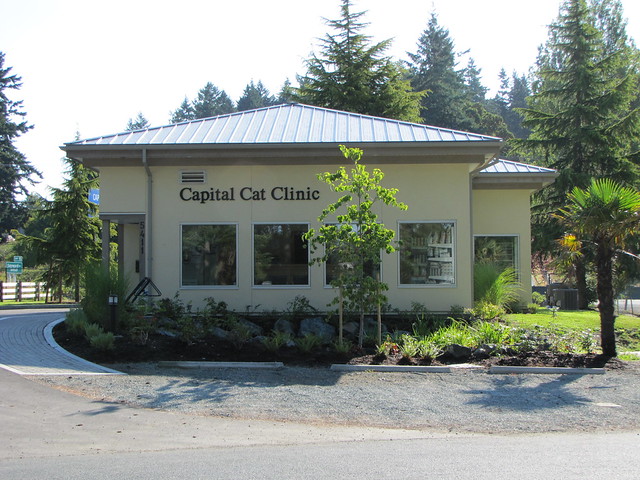
Well, not at the Cat Clinic obviously, but on this spot across form the beach where the Cat Clinic stands now once stood a shop that rented kayaks and other assorted water sports accessories, and it was about six years ago that Paula and Bernie bought a used Pamlico play boat from the shop and on this beach that they let me have a try in it. And I've been broke ever since, but loving every minute of it.
Elk Lake is local shorthand; it's actually two connected lakes and parks, Elk Lake, the larger to the north, and Beaver Lake to the south. We were launching from Hamster Beach on Elk Lake. Hamster Beach is named because the beach was once overrun by hamsters. This caused an influx of feral cats to the area, prompting the building of the Cat Clinic-- excuse me, but-- no, I'm busy...I'm writing the blog right now-- just telling the story of Hamster Beach...what?...really? Oh.
Sorry about that. I've just been informed that the name of the beach is Hamsterly Beach, and that my story about the hamsters wasn't very funny anyway. Some people have no sense of humour. Who makes adverbs out of nouns anyway? Hamsterly. Humph.
Anyway, we put in at Hamsterly Beach....
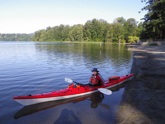
...and carefully avoided the rowers from the nearby rowing centre.
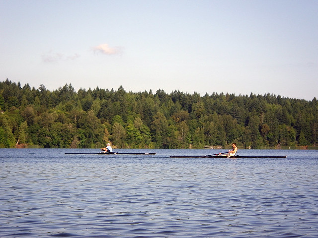
Sunny and warm, water like glass. We decided to go around the shores of both lakes.
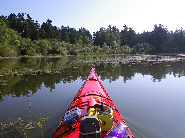
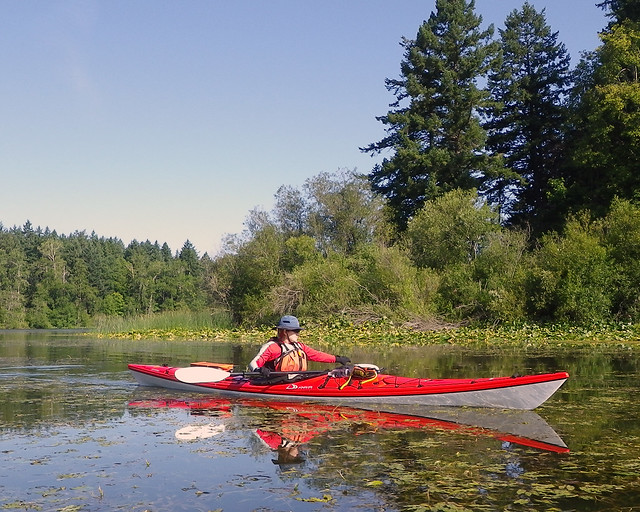
We saw an eagle perched high in a tree surveying its domain, and a fish jump nearly two metres out of the water. How strange that was! Straight up like a mackerel missile, although it was probably a trout or a bass. We meandered around the south end of Beaver Lake. And then we saw turtles.
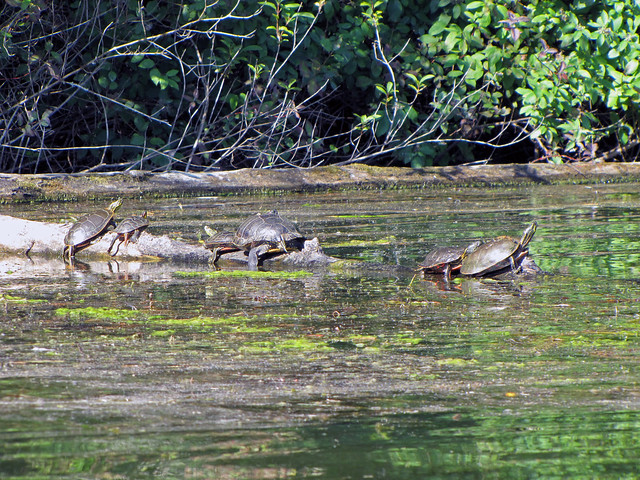
There were seven on this log, although one had scampered back into the water by the time I got my camera out.
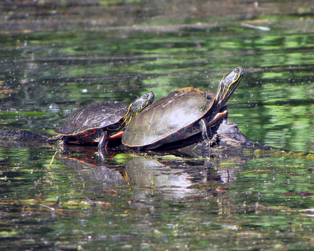
I think these are the Western Painted Turtle, an endangered species. The Habitat Acquisition Trust is monitoring the plight of the Western Painted Turtle -- check out their website here.
A few minutes later we found another turtle going solo on an different log. I think this one is a Slider.
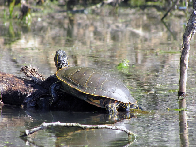
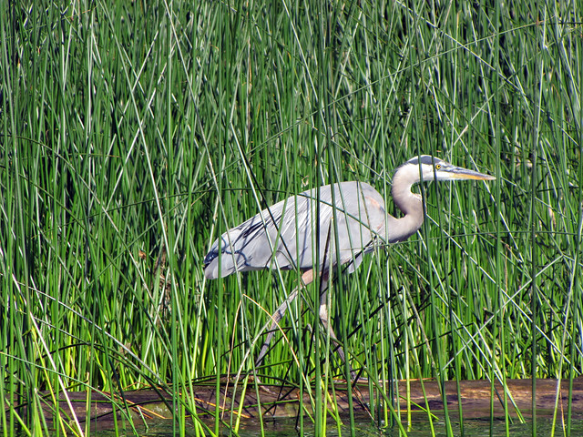
As we rounded the north end of Elk Lake, we saw a heron in stealth mode in the reeds.
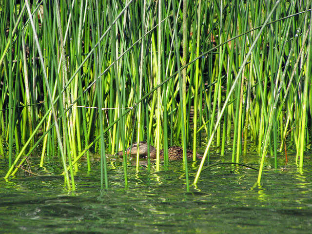
It was such a good idea that even the ducks were trying it.
The end of the paddle drew near. Where does the time go?
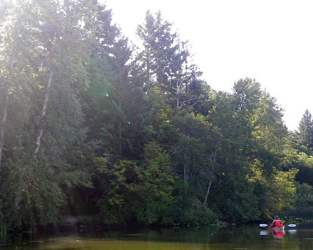
Trip Length: 10.44 km
YTD: 180.13 km
More pictures are here.
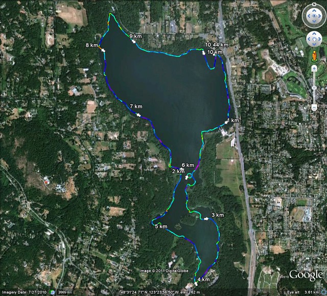
It's also a fitting place to paddle, as my paddling career (such as it is) started right here:

Well, not at the Cat Clinic obviously, but on this spot across form the beach where the Cat Clinic stands now once stood a shop that rented kayaks and other assorted water sports accessories, and it was about six years ago that Paula and Bernie bought a used Pamlico play boat from the shop and on this beach that they let me have a try in it. And I've been broke ever since, but loving every minute of it.
Elk Lake is local shorthand; it's actually two connected lakes and parks, Elk Lake, the larger to the north, and Beaver Lake to the south. We were launching from Hamster Beach on Elk Lake. Hamster Beach is named because the beach was once overrun by hamsters. This caused an influx of feral cats to the area, prompting the building of the Cat Clinic-- excuse me, but-- no, I'm busy...I'm writing the blog right now-- just telling the story of Hamster Beach...what?...really? Oh.
Sorry about that. I've just been informed that the name of the beach is Hamsterly Beach, and that my story about the hamsters wasn't very funny anyway. Some people have no sense of humour. Who makes adverbs out of nouns anyway? Hamsterly. Humph.
Anyway, we put in at Hamsterly Beach....

...and carefully avoided the rowers from the nearby rowing centre.

Sunny and warm, water like glass. We decided to go around the shores of both lakes.


We saw an eagle perched high in a tree surveying its domain, and a fish jump nearly two metres out of the water. How strange that was! Straight up like a mackerel missile, although it was probably a trout or a bass. We meandered around the south end of Beaver Lake. And then we saw turtles.

There were seven on this log, although one had scampered back into the water by the time I got my camera out.

I think these are the Western Painted Turtle, an endangered species. The Habitat Acquisition Trust is monitoring the plight of the Western Painted Turtle -- check out their website here.
A few minutes later we found another turtle going solo on an different log. I think this one is a Slider.

As we rounded the north end of Elk Lake, we saw a heron in stealth mode in the reeds.

It was such a good idea that even the ducks were trying it.

The end of the paddle drew near. Where does the time go?

Trip Length: 10.44 km
YTD: 180.13 km
More pictures are here.

Saturday, August 06, 2011
At Land's End
With it half over, it looks like summer has finally arrived.The last ten days or so might be the first long stretch of the year where we've had seasonal temperatures. By "seasonal temperatures" I mean a daytime high that reaches the normal expected average high for the day, and by "of the year" I mean since January 1. And sadly, I don't believe that to be an exaggeration.
Louise and I decided to check out a put-in I'd never heard about until discovering it on Mike Jackson's blog. However, a certain member of the family seemed intent on stopping us from leaving the house on this sunny day. Or maybe he was trying to save me from a fashion faux pas. Or faux paw in his case. "You really want want to go out of the house wearing this? You'll look like a giant melon. You'll thank me later."
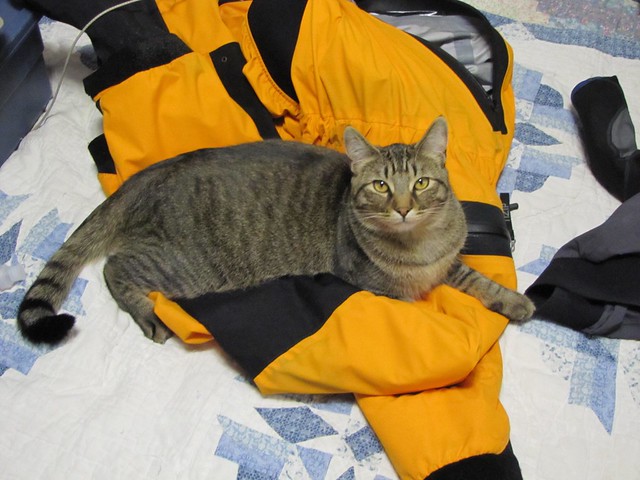
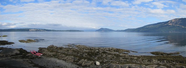
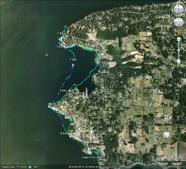
The launch point was at the northern tip of the Saanich Peninsula, at the end of Land's End Road, aptly named because at the end of the road, there ain't no more land. From here north, you're into the Gulf Islands (that's Salt Spring Island on the right in the photo below, just a short hop of about 2.5 km away), but if you paddle south, you're entering Saanich Inlet.
We didn't get off to a good start. Many pleasure boats cruise these waters and a big one roared by just as we were launching. At the start of every paddle Louise's stomach needs a few moments to became acclimated to being on the ocean, a few moments that she didn't get this time as the pleasure craft's large wake caught us just as we were heading out.
We waited a few minutes for her stomach to settle, then proceeded south.
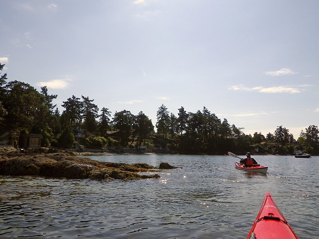
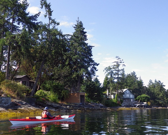
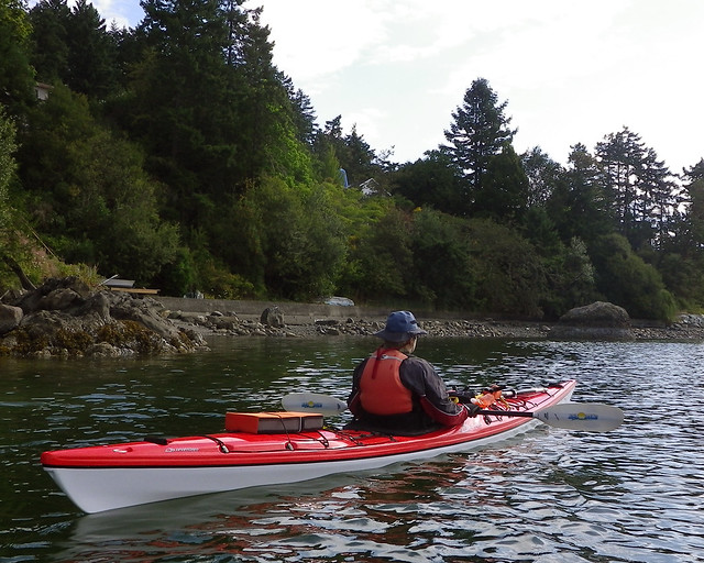
We were in the area of multi-million dollar homes. You can tell because all the homes are huge and are miles apart. Apparently rich people don't like living too close to other rich people.
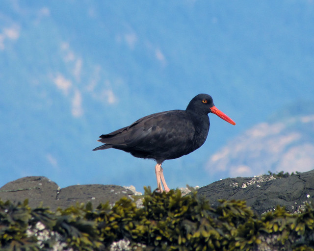
The oystercatchers don't really care where they live as long as there is something to eat.
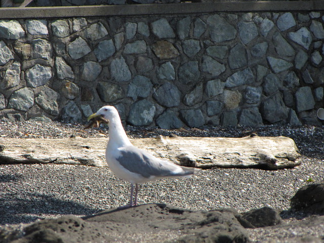
Speaking of something to eat, we saw a seagull trying to choke down a starfish. Not a great picture -- the seagull was determined to stay out of focus.
We meandered through coves and bays as we made our way south, paddling a piece of local coastline that we'd never travelled before thus enabling us to cross off a few more kilometres on our quest to paddle the Slowest Circumnavigation of Vancouver Island.
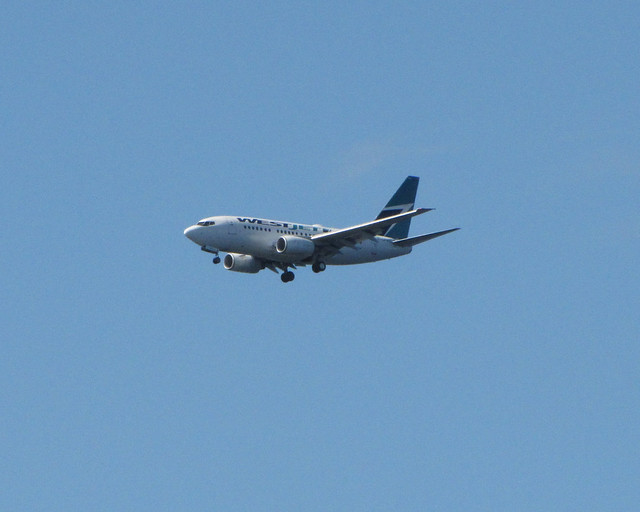
We even paddled near the flight path to the airport.
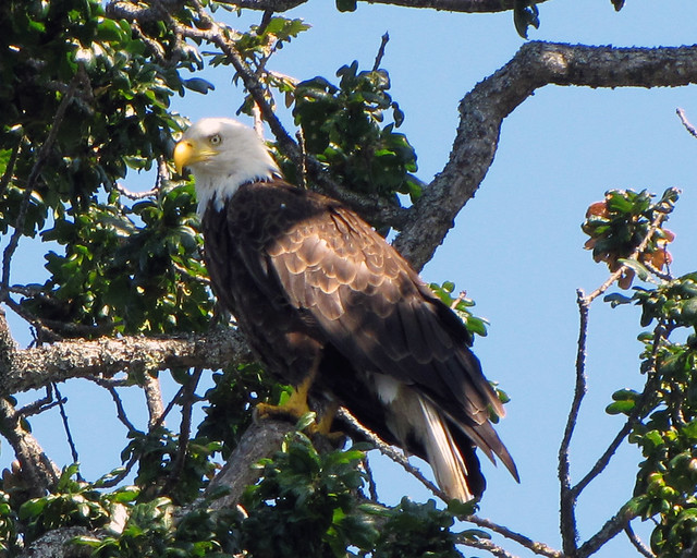
WestJet wasn't doing the only flying today. We followed an eagle for a while as he fluttered from tree to tree. (Yeah, "fluttered" is utterly the wrong word to use for an eagle, but I'm tired, and it's late. "Fluttered" is the best you're going to get.)
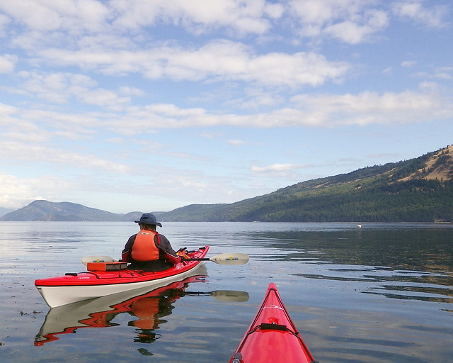
A shaky start but all in all a lovely day.
Trip Length: 7.84 km
YTD: 169.69 km
More pictures are here.
Louise and I decided to check out a put-in I'd never heard about until discovering it on Mike Jackson's blog. However, a certain member of the family seemed intent on stopping us from leaving the house on this sunny day. Or maybe he was trying to save me from a fashion faux pas. Or faux paw in his case. "You really want want to go out of the house wearing this? You'll look like a giant melon. You'll thank me later."

The launch point was at the northern tip of the Saanich Peninsula, at the end of Land's End Road, aptly named because at the end of the road, there ain't no more land. From here north, you're into the Gulf Islands (that's Salt Spring Island on the right in the photo below, just a short hop of about 2.5 km away), but if you paddle south, you're entering Saanich Inlet.

We didn't get off to a good start. Many pleasure boats cruise these waters and a big one roared by just as we were launching. At the start of every paddle Louise's stomach needs a few moments to became acclimated to being on the ocean, a few moments that she didn't get this time as the pleasure craft's large wake caught us just as we were heading out.
We waited a few minutes for her stomach to settle, then proceeded south.

We were in the area of multi-million dollar homes. You can tell because all the homes are huge and are miles apart. Apparently rich people don't like living too close to other rich people.

The oystercatchers don't really care where they live as long as there is something to eat.

Speaking of something to eat, we saw a seagull trying to choke down a starfish. Not a great picture -- the seagull was determined to stay out of focus.

We meandered through coves and bays as we made our way south, paddling a piece of local coastline that we'd never travelled before thus enabling us to cross off a few more kilometres on our quest to paddle the Slowest Circumnavigation of Vancouver Island.

We even paddled near the flight path to the airport.

WestJet wasn't doing the only flying today. We followed an eagle for a while as he fluttered from tree to tree. (Yeah, "fluttered" is utterly the wrong word to use for an eagle, but I'm tired, and it's late. "Fluttered" is the best you're going to get.)

A shaky start but all in all a lovely day.

Trip Length: 7.84 km
YTD: 169.69 km
More pictures are here.

Friday, August 05, 2011
Province Approves Mega-Yacht Project and Sells Out The Songhees For A Song
The following open letter was posted on the Ocean River blog from Tim Houlihan of Save Victoria Harbour, an umbrella organization helping to protest the planned mega-yacht marina in Victoria Harbour. The Provincial government has now approved the Marina plan and will lease the water lots to the developer for the pricey sum of $24,000 -- annually. Yes, a huge chunk of Crown Land (or seabed in this case) that is undeveloped, unspoilt and picturesque AND IS OWNED BY YOU AND ME will be frittered away for a pittance. $65.75 a day. Okay, if the government has its heart set on spoiling this jewel of a harbour, making it damn near impossible for paddlers and rowers to use, and to promote an industry that relies on the burning of massive amounts of fossil fuels, well so be it, but at least let's get some money for it. $24,000 a year -- are you serious? It's no wonder they introduced the Harmonized Sales Tax, they're selling our province away for a song. No, even less than a song...for a verse and half a chorus.
Tim's post follows below:
Despite no approvals from Transport Canada on the Victoria Harbour Airport safety and the with no permit from the Minister of Transport to condone the “substantial interference” to navigation that the proposed marina will create, the BC Government has as of June 23, 2011, offered Community Marine Concepts a lease on the waters that is needed to berth the large vessels on what is now the “non motorized zone ” in Victoria Harbour. Developer’s cost in initial year $24,000.
The detailed information about the offer to lease, and its terms and conditions will not be made public except under a Freedom Of Information request. This request has been made and denied.
Prior to making the offer to the developer, Crown Lands, extinguished the title on the large lot off the Songhees. In doing this, the BC Government, by Ministerial Order, removed the opportunity for a subdivision approving officer at the City of Victoria to call the only public meeting that could be held by an approving body to assist in determining just what is the public interest. I’m sure that all of us would be at City Hall again to say NO! Mega Yacht Marina!
Where are we?
If the Federal Minister of Transport hasn’t made a decision in August of 2011, the Crown Lands people are operating on an indefensible grounds when they claim that, based on their evaluation of the input between Dec 2009 and April 2011, they have accepted a “public paddling corridor” which denies access to the larger human powered vessels today, and will, as water levels rise make the “paddling corridor” under the two concrete platforms more and more inaccessible for even the vessels like kayaks.
How can Crown Lands have made a determination that is in the Public Interest and assume that the non motorized zone of the Victoria Harbour Traffic Scheme will be re-zoned for large yachts when they have not received the final Environment Canada report nor the report on Air and Marine Safety, much less a permit to permit “substantial interference” with navigation, nor have carried out the consultations with “stakeholders” who use the non motorized zone?
How can Crown Lands have made a determination to offer a lease when shared studies of the Environment are not available. Have they used the studies that are subject to the Judicial Review which was adjourned when Transport Canada withdrew the contested Navigable Waters Permit?
Why?
In my opinion, it is obvious that the Crown Lands part of the BC Government and Transport Canada, both of which treat applicants as if they are Government Clients, have not considered the public interest, only the interest of their clients.
What to do? Ask for help!
1. As a human powered vessel user, ask these questions to the Attorney General of BC and the Minister of Justice of Canada. Crown Lands policy says that they are the elected officials to protect the rights of people like you and me who share these waters with the commercial air and marine users.
2 Explain to the Attorney General of BC and the Justice Minister of Canada that, as the operational departments of the BC Government and Transport Canada, treat the applicant -as client, you want the Attorney General of BC to intercede for you as a citizen of Canada and BC and protect these shared rights. Ensure that the non motorized zone of Victoria Harbour remains.
Please write now:
Attorney General BC
Honourable Barry Penner
PO Box 9044 Stn Prov Govt
Victoria BC V8W 9E2
Phone: 250 387-1866
Fax: 250 387-6411
Thursday, August 04, 2011
Umiak Yak
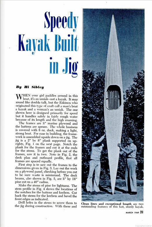
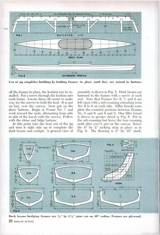
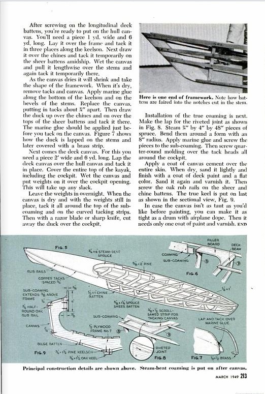
According to the March 1949 issue of Popular Science, this is an umiak, the women's version of the kayak. And while one hates to take issue with the venerable PopSci, Wikipedia describes an umiak as a large open boat used by both the Inuit and the Yupik, usually around 10 metres long, but with some known to have been 18 metres long and carrying as many as 30 people. And they were used by both sexes. So no, PopSci, I think what you've got here is just a kayak.
Waiatt Bay, Quadra Island
This summer, I got the chance to do something really special. As a volunteer assistant, I joined a biology project. A friend of mine in Straitwatch passed on an appeal from her friend Amy for volunteers to stay at an isolated campsite on Quadra Island, and take samples from beaches. Paddling skills would be an asset.  I joined three other volunteers and Amy for five days on the shores of Waiatt Bay. All these photos were taken by Amy Groesbeck, earlier this summer at similar trips. You won't see any photos of me in this post. You wouldn't want to. The day before the trip, I went to the dermatologist and had eight pink fleshy moles burned off my face with liquid nitrogen. Yuck. A good week to be out in the middle of the woods and the sea, away from most people. It was a good time -- I got on the water every day in small boats, and paddled miles of unfamiliar shorelines.

There's an app for that
Our transportation from Heriot Bay to Waiatt Bay at the north end of Quadra Island was on a boat called the Gung Ho, skippered by Harper Graham. He has a sensible manner that makes passengers feel confident that he knows where he's going and what he's got to do to get there. Of course he knows! On the dashboard in his wheelhouse, next to the throttle controls for the boat's engine and a GPS locator, lies an iPhone in its rubbery case. Yup, an iPhone. He took a text message or two before we finished motoring out of Heriot Bay. He also opened up an app or two and swiped at the phone's screen as he approached the islets in the bay. Perfect navigation. There's an app for that, apparently. The bay is sheltered with several small islands that make up Octopus Islands Marine Park. Though it's only an hour away from Heriot Bay, Waiatt feels really isolated. That's partly because there's only one cabin visible along the shore, and partly because the second-growth timber has gotten pretty thick so the logging clear-cuts are all grown back in.
Here's a photo that Amy took of the place we camped, on the north shore of Waiatt Bay at the place the chart calls "Log Dump." This little cove has a stream running into the bay, and a midden where we camped, all thoroughly stomped on by the logging done here. Two old sheds and a camper are all falling to pieces in the trees. To see lots of photos of how Amy Groesbeck investigates clam gardens, go to her Flickr page and check out the right hand column of photo galleries. Some of them are labelled "Clam Garden 2011 - Trip 1" which took place in April 2011, through Trip 4 which took place in late June 2011. Those are the ones especially clam-appropriate.
All I have is a red canoe, three paddles and the truth(with apologies to U2 and Bono)
The skills to handle small boats are practical skills, with real-life applications for modern work in the sciences. One field that puts canoes and kayaks to serious use is... intertidal biology! At least, it does here on the wet coast.
We set out with two ancient canoes -- one green, one red -- and my five-year-old little inflatable kayak. The photo Amy took shows a dark green boat she used on an earlier trip this summer. The canoes were laden with highly technical scientific sampling equipment. That's 5-gallon plastic pails, garden trowels, rubber-palmed garden gloves, spiral-bound notebooks and Zip-Loc freezer bags. Okay, Amy had a transit of some kind with a laser level, too.
  And here's Amy holding some squares she made, 25 cm on a side made out of 1-inch PVC tubing, so we could dig holes exactly 25 cm across. We had to dig them 30 cm deep, which is exactly the length from my elbow to my knuckles. I love the precision of scientific work! In a few beaches, there were experiments placed where Amy buried hand-made mesh bags holding living clams.
Oh, and I was also trained in how to make a sampling device. A kitchen scrubber called a Tuffy was attached to a ten-inch piece of rebar with a cable tie. Easy as pie. After the rebar was pounded into a clam garden, the Tuffy would sit there for four days, collecting anonymous sludge and (with any luck) clam spat. Apparently, intertidal biologists have been trying to figure out how to collect clam spat, and inventing various devices. Someone lucked into using kitchen scrubbers, and found that the Tuffy brand was particularly effective. Did I mention that this project had some funding from grants? Your tax dollars at work, and very efficiently, too. Why waste a biologist's time hand-knitting spat collecting filters when an affordable commercial alternative is easily available. The fun part is pounding the rebar into the garden, when the pounding has to be done underwater. Smack! Smack! into the water. "Science! Doing it all for science!" Spit out muddy sea water. "I'm still having fun!"
 Dunno what YOU did on your vacation, but I sat on muddy beaches, dug holes, and collected clam spat. I didn't even ask if spat was gametes or zygotes. I wasn't the one picking up the Tuffy scrubbers and putting them in Zip-Loc freezer bags, and I didn't really need to know.
  Nature's Art
On one island owned by a family that Amy knows, there's a cabin, hidden in the trees. It's decorated with all kinds of handmade art objects, made from wood and beach materials and boating materials. Visitors to the bay have been bringing their art objects here for years! When we got back to our camp at the log dump site, I took out my knitting and made a sweater. A little one, doll-size. The next day, we found a piece of driftwood and made a little person to put in the art cabin.

All in all they're just another rock in the wall
 If you look over a clam garden at high tide, whether from a boat or from the shore, you probably wouldn't see anything to tell you that this is a place shaped by human gardeners.
 When the tide is a little lower than full, you might guess at the shallows near shore, usually in a small bay or between two rocky points. But when the tide is low, approaching a zero tide, the clam garden is revealed.
 From shore it looks like a flat, almost level shallow beach. It's mostly free of rocks bigger than your head. Most of the beach is sediments mixed with small stones and bits of broken clam shell. The clam shell hash was added deliberately, to change the local pH of the water and send chemical messages to floating clam spat that here was some good clam habitat to settle down and grow! At the edge of the garden is a rocky ledge. Most of these ledges don't stand up much higher than the level of the beach, maybe ankle-high. But if you look past the edge of the ledge, you can see that the sea bottom drops down suddenly. You're standing at the top of a wall made of rocks piled on rocks.
  One of these walls can be as high as three or four metres or more above its underwater base. Most of the visible rocks look small enough for one person to have rolled down the beach into place, about twenty to thirty centimetres across. The rocks at the bottom of the wall three or four metres or more underwater may be larger, maybe half a metre across or bigger.
  But that's really enough talking that I can do about clam gardens. To learn more about them, check out the totally awesome book Clam Garden by Judith Williams. You can read more about it at the publisher's website. There's a copy in the Greater Victoria Public Library!
A bird in the hand is worth a snake in the shallows
We got to see lots of wildlife, around the shores of Waiatt Bay. My little kayak is so quiet that I could sneak up on these animals, shyer than their city cousins in Cadboro Bay. A few seals swam by to check out our boats. Raccoons like clam gardens! A couple of times we saw two or three raccoons waddling over the flats at low tide, digging for clams and various invertebrates. A mink poked out its head from the shoreline bushes to look at the canoes that had just gone by, then stare at me and squeak "oh crap!" before darting away. And right in our camp, a little brown weasel came scampering by and glared at everyone. For birds, there were ravens watching our every move, as well as kingfishers and a hummingbird, and a large eagle. I'm sure that we all were very glad that no black bears or cougars came by for a visit.
The most striking animal sighting was when Sara squeaked while sitting on a rocky ledge one afternoon. "A snake!" she squawked. A garter snake was sunning itself on the ledge beside her. When it slithered into the lukewarm sea water, our overjoyed amateur naturalists joined the actual biologists. A snake that swam in sea water! oooOOOoo!
Well, maybe the most striking animal was the polychaete, a bristly marine worm that snaked out of a tunnel in the side of the sampling hole that Sara was digging. Another squawk announced her shock at the arrival of the sandworm. This probably wasn't the kind of polychaete that the Kayak Yak paddle group found in Portage Inlet, making jelly ball egg sacs. That worm, according to Dr Kelly Sendal, probably looks rather like a bratwurst. This one in Sara's gloved hands looked more like a giant pink earthworm with tiny millipede legs. She carefully put it aside and went back to digging. And found another one in her next hole. Only a tiny squawk that time. Tough gal!
I love your lab!
The first time we catalogued clams, both living clams and the shells of dead clams, our group gathered under the tarp over our kitchen area. Seated on five-gallon pails, we hunched over our shells. Annemarie sorted shells, Amy and Kim measured shells with calipers, Sarah and I recorded the measurements in Amy's notebooks. Plenty of banter. "Clam me," I said. "All Clams, All Dead." A rain squall fell around us, and we got chilled and stiff before we were done and dinner could be made. The second time was much more idyllic. That afternoon was sunny, so after lunch on a rocky slope below a midden across the bay from camp, we set up the calipers and notebooks. Each of us moved into the shade or sunshine at will by shifting a couple of feet on the moss. Our postures were not hunched this time, but varied from leaning on one elbow like a diner at a Roman feast to laying back against rocky slopes perfectly designed to support our backs and heads. More banter, as living clams were found among the dead samples and a dead clam among the living samples. Zombie clams don't groan "braiiinnzz", we decided, because they don't have brains. They call out for nerves.
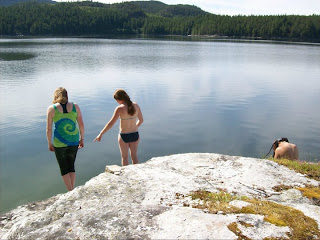 Looking out across the bay was wonderful. I'd always thought that doing science involved wearing lab coats, not bathing suits or my shortie wetsuit. This place was much nicer than a basement lab somewhere. "I love what you've done with your lab!"
In an Octopus's Garden
We came to a clam garden one day that had an unusual living thing at the edge of a particularly high wall. It looked rather like a dahlia flower made out of yellowish jellyfish. "What the heck is that?" Amy wondered out loud. "A squid's egg sac?"
"Or an octopus's egg sac?" I suggested. "There are supposedly a lot of octopus around here. This is Octopus Islands Marine Park, after all." That didn't seem likely. Octopus mothers usually put their egg sacs in sheltered places, and protect them till the little ones hatch. But I found photos online of octopus egg sacs that look pretty much like what we saw.
We got to work taking samples, and Amy wrote notes in her books. When she asked "What shall we call this beach?" there was really only one name to consider: Octopus's Garden.
Here Comes The Rain Again
 The weather was almost perfect -- very little breeze on the water the second day, and a half-hour rain sqall were the only variations from sunny and mild. In this sheltered bay the ocean water gets about as warm as it does anywhere along the coast, so it felt much warmer than where I usually paddle near Victoria. There were some two dozen sailboats anchored in sheltered places around Waiatt Bay, the most crowded that Amy had ever seen this area. Nights were cool but not really cold. And just in case perfect was asking too much, an hour before the Gung Ho returned to take us back to Heriot Bay, the clouds opened up. All our tents were soaked as we stuffed them into their bags. But it was still fun! And I sure hope to do it again next year.
 I joined three other volunteers and Amy for five days on the shores of Waiatt Bay. All these photos were taken by Amy Groesbeck, earlier this summer at similar trips. You won't see any photos of me in this post. You wouldn't want to. The day before the trip, I went to the dermatologist and had eight pink fleshy moles burned off my face with liquid nitrogen. Yuck. A good week to be out in the middle of the woods and the sea, away from most people. It was a good time -- I got on the water every day in small boats, and paddled miles of unfamiliar shorelines.

There's an app for that
Our transportation from Heriot Bay to Waiatt Bay at the north end of Quadra Island was on a boat called the Gung Ho, skippered by Harper Graham. He has a sensible manner that makes passengers feel confident that he knows where he's going and what he's got to do to get there. Of course he knows! On the dashboard in his wheelhouse, next to the throttle controls for the boat's engine and a GPS locator, lies an iPhone in its rubbery case. Yup, an iPhone. He took a text message or two before we finished motoring out of Heriot Bay. He also opened up an app or two and swiped at the phone's screen as he approached the islets in the bay. Perfect navigation. There's an app for that, apparently.
 The bay is sheltered with several small islands that make up Octopus Islands Marine Park. Though it's only an hour away from Heriot Bay, Waiatt feels really isolated. That's partly because there's only one cabin visible along the shore, and partly because the second-growth timber has gotten pretty thick so the logging clear-cuts are all grown back in.
Here's a photo that Amy took of the place we camped, on the north shore of Waiatt Bay at the place the chart calls "Log Dump." This little cove has a stream running into the bay, and a midden where we camped, all thoroughly stomped on by the logging done here. Two old sheds and a camper are all falling to pieces in the trees.
 To see lots of photos of how Amy Groesbeck investigates clam gardens, go to her Flickr page and check out the right hand column of photo galleries. Some of them are labelled "Clam Garden 2011 - Trip 1" which took place in April 2011, through Trip 4 which took place in late June 2011. Those are the ones especially clam-appropriate.
All I have is a red canoe, three paddles and the truth(with apologies to U2 and Bono)
The skills to handle small boats are practical skills, with real-life applications for modern work in the sciences. One field that puts canoes and kayaks to serious use is... intertidal biology! At least, it does here on the wet coast.

We set out with two ancient canoes -- one green, one red -- and my five-year-old little inflatable kayak. The photo Amy took shows a dark green boat she used on an earlier trip this summer. The canoes were laden with highly technical scientific sampling equipment. That's 5-gallon plastic pails, garden trowels, rubber-palmed garden gloves, spiral-bound notebooks and Zip-Loc freezer bags.
 Okay, Amy had a transit of some kind with a laser level, too.
  And here's Amy holding some squares she made, 25 cm on a side made out of 1-inch PVC tubing, so we could dig holes exactly 25 cm across. We had to dig them 30 cm deep, which is exactly the length from my elbow to my knuckles. I love the precision of scientific work! In a few beaches, there were experiments placed where Amy buried hand-made mesh bags holding living clams.
Oh, and I was also trained in how to make a sampling device. A kitchen scrubber called a Tuffy was attached to a ten-inch piece of rebar with a cable tie. Easy as pie. After the rebar was pounded into a clam garden, the Tuffy would sit there for four days, collecting anonymous sludge and (with any luck) clam spat. Apparently, intertidal biologists have been trying to figure out how to collect clam spat, and inventing various devices. Someone lucked into using kitchen scrubbers, and found that the Tuffy brand was particularly effective. Did I mention that this project had some funding from grants? Your tax dollars at work, and very efficiently, too. Why waste a biologist's time hand-knitting spat collecting filters when an affordable commercial alternative is easily available. The fun part is pounding the rebar into the garden, when the pounding has to be done underwater. Smack! Smack! into the water. "Science! Doing it all for science!" Spit out muddy sea water. "I'm still having fun!"
 Dunno what YOU did on your vacation, but I sat on muddy beaches, dug holes, and collected clam spat. I didn't even ask if spat was gametes or zygotes. I wasn't the one picking up the Tuffy scrubbers and putting them in Zip-Loc freezer bags, and I didn't really need to know.
  Nature's Art
On one island owned by a family that Amy knows, there's a cabin, hidden in the trees. It's decorated with all kinds of handmade art objects, made from wood and beach materials and boating materials. Visitors to the bay have been bringing their art objects here for years! When we got back to our camp at the log dump site, I took out my knitting and made a sweater. A little one, doll-size. The next day, we found a piece of driftwood and made a little person to put in the art cabin.

All in all they're just another rock in the wall
 If you look over a clam garden at high tide, whether from a boat or from the shore, you probably wouldn't see anything to tell you that this is a place shaped by human gardeners.
 When the tide is a little lower than full, you might guess at the shallows near shore, usually in a small bay or between two rocky points. But when the tide is low, approaching a zero tide, the clam garden is revealed.
 From shore it looks like a flat, almost level shallow beach. It's mostly free of rocks bigger than your head. Most of the beach is sediments mixed with small stones and bits of broken clam shell. The clam shell hash was added deliberately, to change the local pH of the water and send chemical messages to floating clam spat that here was some good clam habitat to settle down and grow! At the edge of the garden is a rocky ledge. Most of these ledges don't stand up much higher than the level of the beach, maybe ankle-high. But if you look past the edge of the ledge, you can see that the sea bottom drops down suddenly. You're standing at the top of a wall made of rocks piled on rocks.
  One of these walls can be as high as three or four metres or more above its underwater base. Most of the visible rocks look small enough for one person to have rolled down the beach into place, about twenty to thirty centimetres across. The rocks at the bottom of the wall three or four metres or more underwater may be larger, maybe half a metre across or bigger.
  But that's really enough talking that I can do about clam gardens. To learn more about them, check out the totally awesome book Clam Garden by Judith Williams. You can read more about it at the publisher's website. There's a copy in the Greater Victoria Public Library!
A bird in the hand is worth a snake in the shallows
We got to see lots of wildlife, around the shores of Waiatt Bay. My little kayak is so quiet that I could sneak up on these animals, shyer than their city cousins in Cadboro Bay. A few seals swam by to check out our boats. Raccoons like clam gardens! A couple of times we saw two or three raccoons waddling over the flats at low tide, digging for clams and various invertebrates. A mink poked out its head from the shoreline bushes to look at the canoes that had just gone by, then stare at me and squeak "oh crap!" before darting away. And right in our camp, a little brown weasel came scampering by and glared at everyone. For birds, there were ravens watching our every move, as well as kingfishers and a hummingbird, and a large eagle. I'm sure that we all were very glad that no black bears or cougars came by for a visit.
The most striking animal sighting was when Sara squeaked while sitting on a rocky ledge one afternoon. "A snake!" she squawked. A garter snake was sunning itself on the ledge beside her. When it slithered into the lukewarm sea water, our overjoyed amateur naturalists joined the actual biologists. A snake that swam in sea water! oooOOOoo!
Well, maybe the most striking animal was the polychaete, a bristly marine worm that snaked out of a tunnel in the side of the sampling hole that Sara was digging. Another squawk announced her shock at the arrival of the sandworm. This probably wasn't the kind of polychaete that the Kayak Yak paddle group found in Portage Inlet, making jelly ball egg sacs. That worm, according to Dr Kelly Sendal, probably looks rather like a bratwurst. This one in Sara's gloved hands looked more like a giant pink earthworm with tiny millipede legs. She carefully put it aside and went back to digging. And found another one in her next hole. Only a tiny squawk that time. Tough gal!
I love your lab!
The first time we catalogued clams, both living clams and the shells of dead clams, our group gathered under the tarp over our kitchen area. Seated on five-gallon pails, we hunched over our shells. Annemarie sorted shells, Amy and Kim measured shells with calipers, Sarah and I recorded the measurements in Amy's notebooks. Plenty of banter. "Clam me," I said. "All Clams, All Dead." A rain squall fell around us, and we got chilled and stiff before we were done and dinner could be made.
 The second time was much more idyllic. That afternoon was sunny, so after lunch on a rocky slope below a midden across the bay from camp, we set up the calipers and notebooks. Each of us moved into the shade or sunshine at will by shifting a couple of feet on the moss. Our postures were not hunched this time, but varied from leaning on one elbow like a diner at a Roman feast to laying back against rocky slopes perfectly designed to support our backs and heads. More banter, as living clams were found among the dead samples and a dead clam among the living samples. Zombie clams don't groan "braiiinnzz", we decided, because they don't have brains. They call out for nerves.
 Looking out across the bay was wonderful. I'd always thought that doing science involved wearing lab coats, not bathing suits or my shortie wetsuit. This place was much nicer than a basement lab somewhere. "I love what you've done with your lab!"
In an Octopus's Garden
We came to a clam garden one day that had an unusual living thing at the edge of a particularly high wall. It looked rather like a dahlia flower made out of yellowish jellyfish. "What the heck is that?" Amy wondered out loud. "A squid's egg sac?"
"Or an octopus's egg sac?" I suggested. "There are supposedly a lot of octopus around here. This is Octopus Islands Marine Park, after all." That didn't seem likely. Octopus mothers usually put their egg sacs in sheltered places, and protect them till the little ones hatch. But I found photos online of octopus egg sacs that look pretty much like what we saw.
We got to work taking samples, and Amy wrote notes in her books. When she asked "What shall we call this beach?" there was really only one name to consider: Octopus's Garden.
Here Comes The Rain Again
 The weather was almost perfect -- very little breeze on the water the second day, and a half-hour rain sqall were the only variations from sunny and mild. In this sheltered bay the ocean water gets about as warm as it does anywhere along the coast, so it felt much warmer than where I usually paddle near Victoria. There were some two dozen sailboats anchored in sheltered places around Waiatt Bay, the most crowded that Amy had ever seen this area. Nights were cool but not really cold. And just in case perfect was asking too much, an hour before the Gung Ho returned to take us back to Heriot Bay, the clouds opened up. All our tents were soaked as we stuffed them into their bags. But it was still fun! And I sure hope to do it again next year.
Subscribe to:
Comments (Atom)


